Click on a date/time to view the file as it appeared at that time.
| Date/Time | Thumbnail | Dimensions | User | Comment |
current | 07:41, 21 September 2015 | | 3,844 × 3,239 (1.58 MB) | 4ing | 
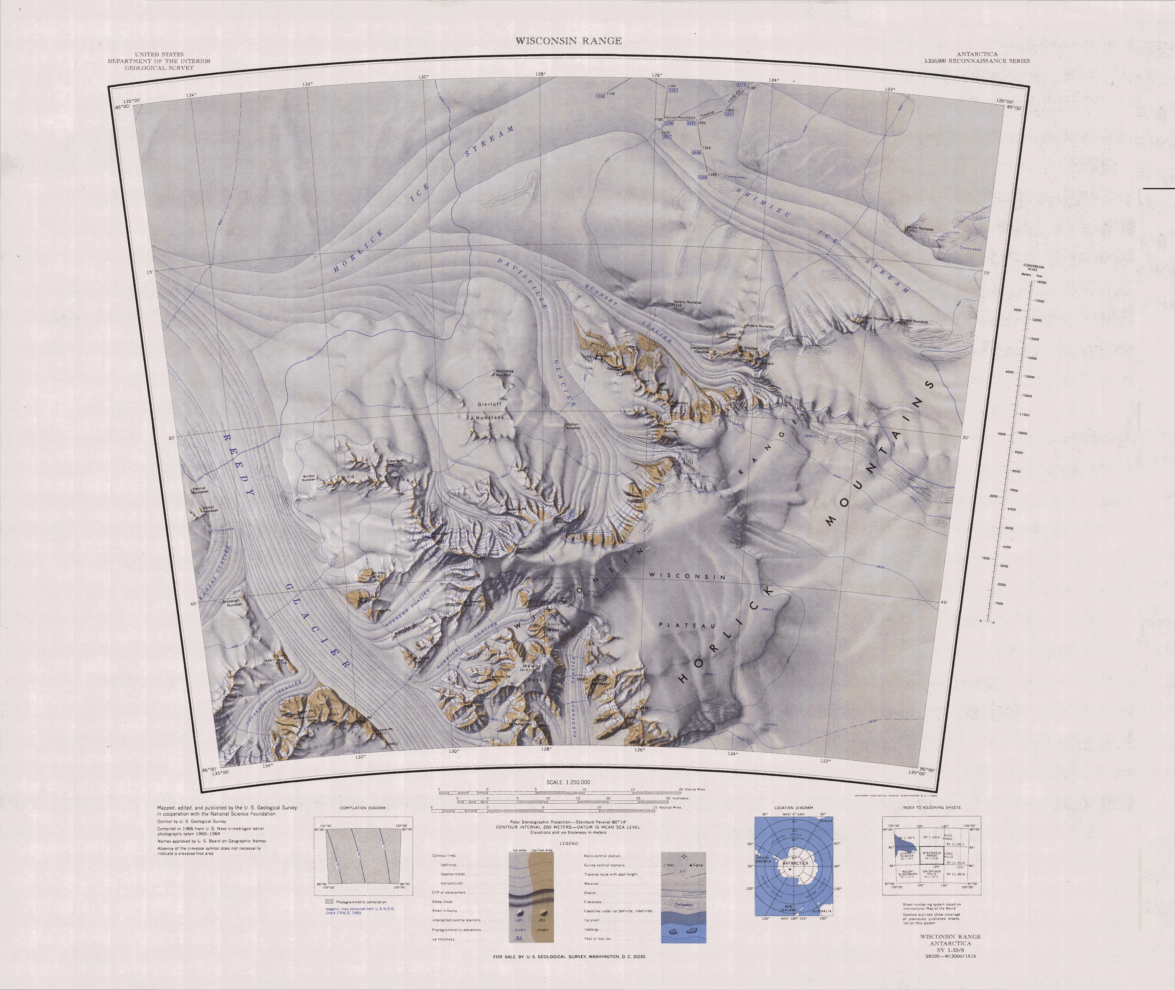
== {{int:filedesc}} == {{Information |description={{en|1=1:250,000-scale topographic reconnaissance map of the Wisconsin Range area from 120°-135°E to 85°-86°S in Antarctica, including the Ready Glacier. Mapped, edited and published by the U.S. Geo... |
The following pages on the English Wikipedia use this file (pages on other projects are not listed):
The following other wikis use this file:
- Usage on bg.wikipedia.org
- Usage on ceb.wikipedia.org
- Usage on de.wikipedia.org
- Usage on it.wikipedia.org
- Usage on lld.wikipedia.org
- Usage on nn.wikipedia.org
- Usage on pl.wikipedia.org
- Usage on www.wikidata.org