Loading
  • 21 Aug, 2019

  • By, Wikipedia

File:CD-001a-Tablette De Ga-Sur.jpg

Transferred from fr.wikipedia to Commons by Bloody-libu using CommonsHelper.

The original description page was here. All following user names refer to fr.wikipedia.
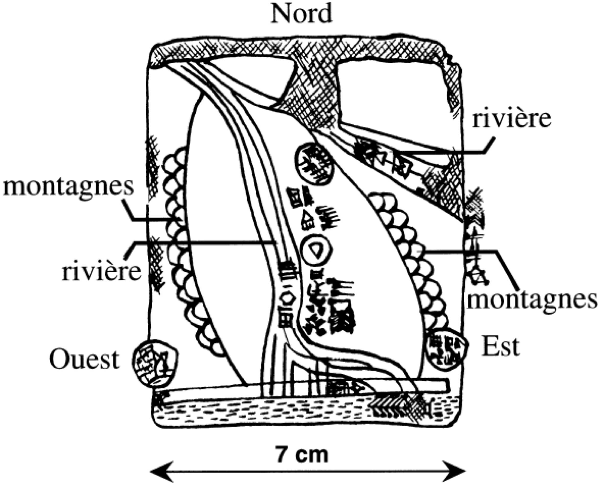
  • 2006-07-19 09:36 Carlo denis 2475×2008× (244399 bytes) Esquisse explicative de la plus ancienne carte géographique connue. La carte figure sur une tablette d'argile sumérienne provenant des fouilles de Ga-Sur à Nuzi (Irak). La tablette est datée de 2500 avant notre ère et est conservée au Musée Sémiti

Captions

Add a one-line explanation of what this file represents

Items portrayed in this file

depicts

image/jpeg

521d43f0477d56e13c7428e6f54bae838f2bd754

244,399 byte

2,008 pixel

2,475 pixel

File history

Click on a date/time to view the file as it appeared at that time.

Date/TimeThumbnailDimensionsUserComment
current18:20, 16 August 2012Thumbnail for version as of 18:20, 16 August 20122,475 × 2,008 (239 KB)File Upload Bot (Magnus Manske)Transfered from fr.wikipedia by User:Bloody-libu using CommonsHelper
The following pages on the English Wikipedia use this file (pages on other projects are not listed):

Global file usage

The following other wikis use this file: