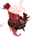
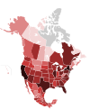
File:COVID-19 Cases By Territories Of The Countries Of North America.svg
Click on a date/time to view the file as it appeared at that time.
| Date/Time | Thumbnail | Dimensions | User | Comment | |
|---|---|---|---|---|---|
| current | 15:24, 18 December 2020 |  | 512 × 596 (139 KB) | Fluffy89502 | ontario |
| 04:43, 18 December 2020 |  | 512 × 596 (139 KB) | Fluffy89502 | update | |
| 06:19, 24 July 2020 |  | 1,789 × 2,154 (329 KB) | DOSGuy | This map is full of fail. There haven't been less cases in BC and Alberta than in Saskatchewan in months. Desperately needs a complete review. | |
| 04:34, 4 July 2020 |  | 1,789 × 2,154 (322 KB) | YanpolGG | Uploaded own work with UploadWizard |
File usage
The following 2 pages use this file:
Global file usage
The following other wikis use this file:
- Usage on es.wikipedia.org
- Usage on ja.wikipedia.org
- Usage on ko.wikipedia.org
- Usage on sq.wikipedia.org
- Usage on uk.wikipedia.org
- Usage on vi.wikipedia.org
- Usage on zh.wikipedia.org