This work is in the public domain in its country of origin and other countries and areas where the copyright term is the author's life plus 100 years or fewer.
You must also include a United States public domain tag to indicate why this work is in the public domain in the United States.
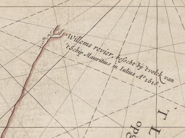
{{Information |description={{en|1=This is an image showing detail of the National Library of Australia's copy of Hessel Gerritsz' 1627 map of the north west coast of Australia entitled "Caert van't Landt van d'Eendracht". This detail shows features label
 You must also include a United States public domain tag to indicate why this work is in the public domain in the United States.
.jpg)