Loading
  • 21 Aug, 2019

  • By, Wikipedia

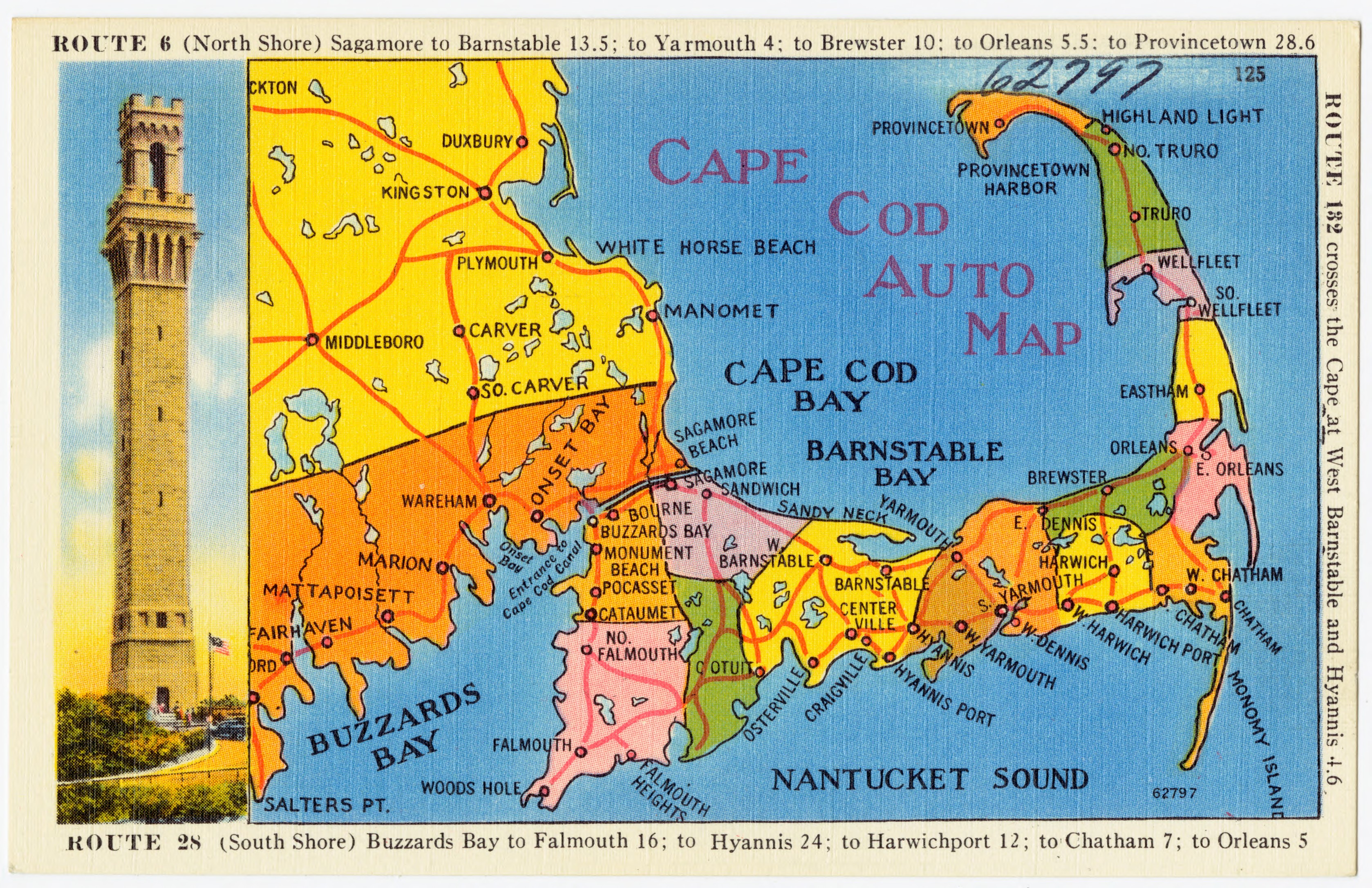
File:Cape Cod Auto Map (62797).jpg

العربية  беларуская (тарашкевіца)  čeština  Deutsch  Ελληνικά  English  español  français  Bahasa Indonesia  italiano  日本語  한국어  македонски  Nederlands  português  русский  sicilianu  slovenščina  ไทย  Tiếng Việt  中文(简体)  中文(繁體)  +/−

Flag of the United States

Captions

Add a one-line explanation of what this file represents

Items portrayed in this file

depicts

image/jpeg

2354758d49d655310c0042848dbb4914db98bd34

2,708,841 byte

2,172 pixel

3,357 pixel

File history

Click on a date/time to view the file as it appeared at that time.

Date/TimeThumbnailDimensionsUserComment
current20:56, 30 December 2015Thumbnail for version as of 20:56, 30 December 20153,357 × 2,172 (2.58 MB)Junkyardsparkle=={{int:filedesc}}== {{Information |description={{en|1='''Title:''' ''Cape Cod Auto Map'' :'''Subjects:''' Maps :'''Places:''' Massachusetts > Barnstable (county) > Provincetown :'''Notes:''' Title from item. :'''Extent:''' 1 print (postcard) : linen t...
The following pages on the English Wikipedia use this file (pages on other projects are not listed):