Click on a date/time to view the file as it appeared at that time.
| Date/Time | Thumbnail | Dimensions | User | Comment |
|---|
| current | 21:30, 28 February 2011 | 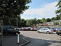 | 640 × 480 (88 KB) | GeographBot | == {{int:filedesc}} == {{Information |description={{en|1=Car park off Park End This car park is between Park End Street and Hythe Bridge Street. The Oxford Canal ends over in the trees in the distance so was this area the Basin?}} |date=2009-06-30 |source |
The following pages on the English Wikipedia use this file (pages on other projects are not listed):
This file contains additional information, probably added from the digital camera or scanner used to create or digitize it.
If the file has been modified from its original state, some details may not fully reflect the modified file.
