Click on a date/time to view the file as it appeared at that time.
| Date/Time | Thumbnail | Dimensions | User | Comment |
|---|
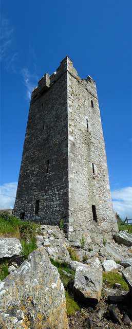
| current | 21:46, 4 February 2011 |  | 257 × 640 (63 KB) | GeographBot | == {{int:filedesc}} == {{Information |description={{en|1=Carrick Kildavnet Castle Carrick Kildavnet (or Kildavnet) Castle is a late 15th century fortified Tower House set at the water's edge with remains of a boat slipway which ran from the back of the ca |
The following page uses this file:
This file contains additional information, probably added from the digital camera or scanner used to create or digitize it.
If the file has been modified from its original state, some details may not fully reflect the modified file.