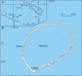
File:Carte Tikehau.png
Click on a date/time to view the file as it appeared at that time.
| Date/Time | Thumbnail | Dimensions | User | Comment | |
|---|---|---|---|---|---|
| current | 02:02, 31 July 2007 |  | 2,815 × 2,586 (159 KB) | Neumeier | |
| 21:01, 13 January 2006 |  | 3,753 × 3,449 (153 KB) | Neumeier | {{Information |Description = Map of the atoll Tikehau (French Polynesia), Carte de l'atoll Tikehau (Polynésie française), Karte vom Atoll Tikehau (Französisch-Polynesien) |Source = redrawn from scanned maps |Date = 13.1.2006 |Author = Urs Neumeier |Per |
File usage
The following page uses this file: