File:Caucasus 300 Map Alt De.png
Click on a date/time to view the file as it appeared at that time.
| Date/Time | Thumbnail | Dimensions | User | Comment | |
|---|---|---|---|---|---|
| current | 08:06, 24 September 2015 | 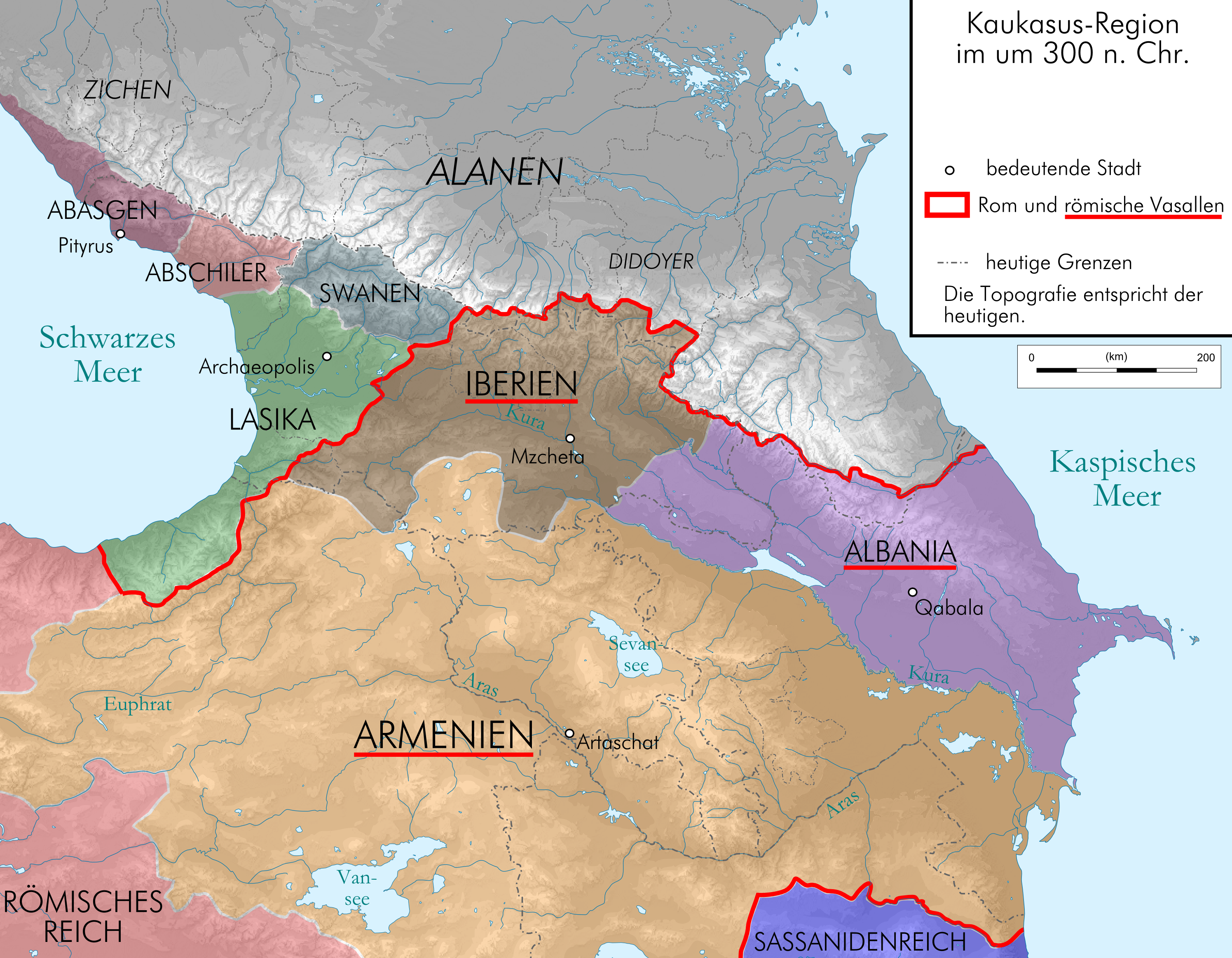 | 2,990 × 2,324 (3.02 MB) | RokerHRO | optipng -o7 -i0 -zc1-9 -zm1-9 -zs0-3 -f0-5 → 13.51% decrease |
| 19:56, 17 August 2009 |  | 2,990 × 2,324 (3.49 MB) | Don-kun | following Fähnrich, Iberia lost southern territories at the end of the rule of Amasasp III (260-265) | |
| 22:04, 8 August 2009 |  | 2,990 × 2,324 (3.48 MB) | Don-kun | {{Information |Description={{en|1=Map of Caucasus around 300 AC in German.}} {{de|1=Kaukasus-Region um 300 n. Chr. Quellen sind http://commons.wikimedia.org/key/File:Geor_earliest_2A.jpg , Putzger historischer Weltatlas Ausgabe 2005, Heinz Fähnrich: Ges |
File usage
The following 4 pages use this file:
Global file usage
The following other wikis use this file:
- Usage on arz.wikipedia.org
- Usage on azb.wikipedia.org
- Usage on ca.wikipedia.org
- Usage on cs.wikipedia.org
- Usage on cv.wikipedia.org
- Usage on de.wikipedia.org
- Usage on el.wikipedia.org
- Usage on eo.wikipedia.org
- Usage on eu.wikipedia.org
- Usage on fr.wikipedia.org
- Usage on hr.wikipedia.org
- Usage on hy.wikipedia.org
- Usage on hyw.wikipedia.org
- Usage on it.wikipedia.org
- Usage on ka.wikipedia.org
- Usage on ko.wikipedia.org
- Usage on nl.wikipedia.org
- Usage on pt.wikipedia.org
- Usage on simple.wikipedia.org
- Usage on sl.wikipedia.org
- Usage on sr.wikipedia.org
- Usage on uk.wikipedia.org
- Usage on vi.wikipedia.org
- Usage on zh.wikipedia.org