File:Central-Eastern-Livingston-Map.png
Click on a date/time to view the file as it appeared at that time.
| Date/Time | Thumbnail | Dimensions | User | Comment | |
|---|---|---|---|---|---|
| current | 10:45, 27 July 2010 | 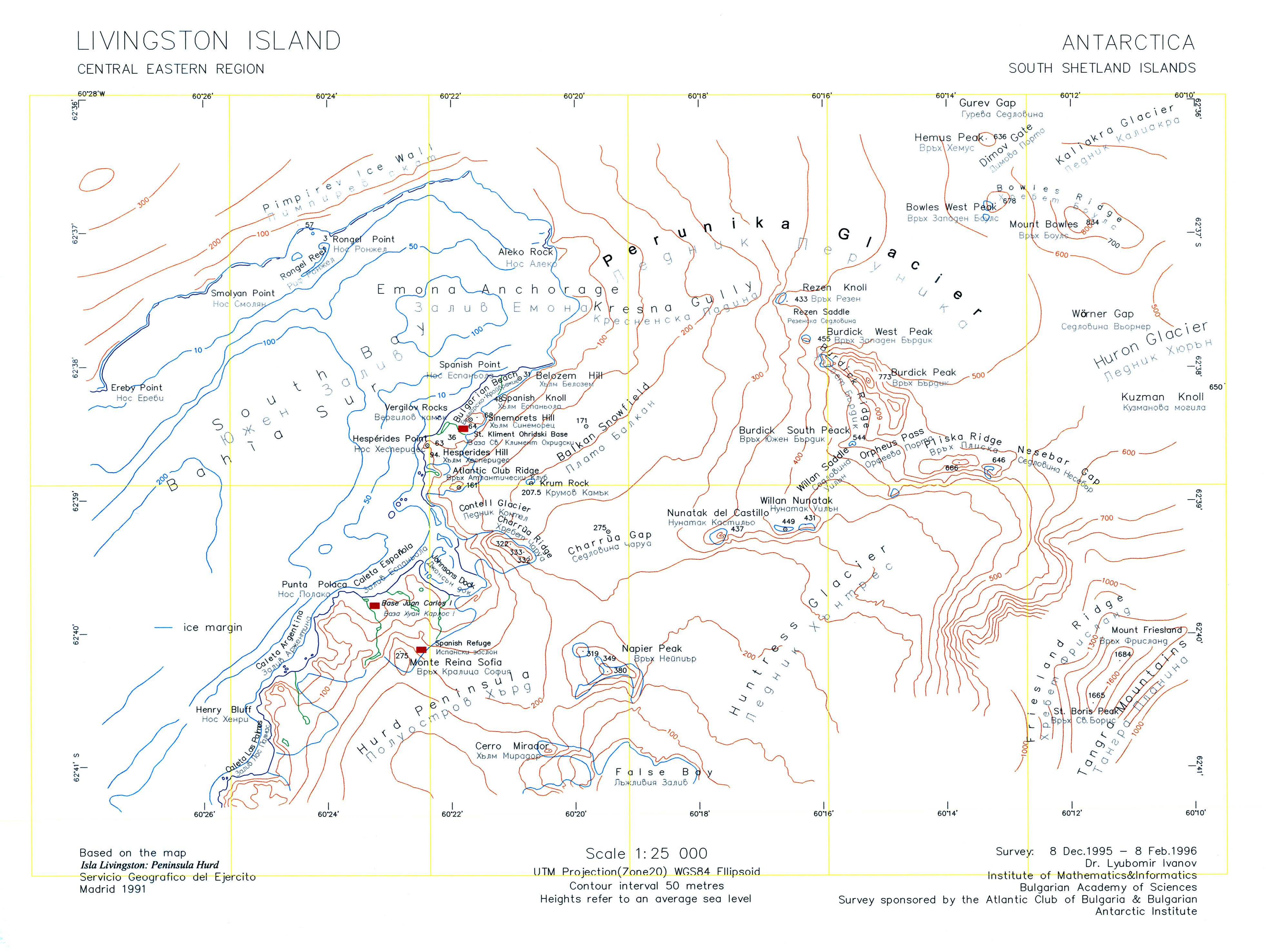 | 3,928 × 2,952 (3.08 MB) | Apcbg | Minor fixes. |
| 08:47, 27 July 2010 |  | 3,928 × 2,952 (33.23 MB) | Apcbg | {{Information |Description={{en|1=A version of the original 1996 map ''L.L. Ivanov. Livingston Island: Central-Eastern Region. Scale 1:25000 topographic map. Sofia: Antarctic Place-names Commission of Bulgaria, 1996.'' uploaded by the author of that map. |
File usage
The following pages on the English Wikipedia use this file (pages on other projects are not listed):
- Aleko Point
- Atlantic Club Ridge
- Balkan Snowfield
- Belozem Hill
- Bowles West Peak
- Bulgarian Beach
- Charrúa Gap
- Contell Glacier
- Dimov Gate
- Emona Anchorage
- Gurev Gap
- Hesperides Hill
- Kresna Gully
- Krum Rock
- Mount Friesland
- Pimpirev Ice Wall
- Rezen Knoll
- Rezen Saddle
- Rongel Point
- Rongel Reef
- Sea Lion Glacier
- Sea Lion Tarn
- Sinemorets Hill
- Smolyan Point
- Spanish Knoll
- Spanish Point (Antarctica)
- St. Boris Peak
- Vergilov Rocks
- Willan Nunatak
- Willan Saddle
Global file usage
The following other wikis use this file:
- Usage on ar.wikipedia.org
- Usage on bg.wikipedia.org
- Usage on he.wikipedia.org
- Usage on it.wikipedia.org
- Usage on nl.wikipedia.org
- Usage on pt.wikipedia.org
- Usage on uk.wikipedia.org