File:Cheik-Saïd 1938.jpg
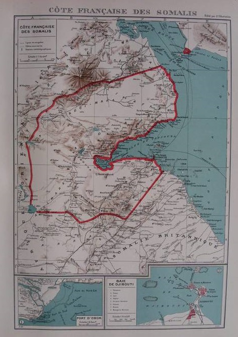
Cette carte présente la frontière entre l'Éritrée italienne et la Côte française des Somalis telle que déterminée par l'Accord Laval-Mussolini de janvier 1935. À l'issue de la Seconde Guerre mondiale, la frontière fut repoussée vers le nord, telle qu'elle avait été avant 1935.
Date
Source
Delcampe.net auction
Author
Édition L'Illustration, 1938
English: Map of French Somaliland, from the Atlas colonial français published by L'Illustration (1938 edition). On the other side of the Strait of Bab el-Mandeb, Cheik-Saïd is clearly shown as a French possession, although it was not.
This map shows the new Italian Eritrea-French Somaliland border as per the Laval-Mussolini Accord of January 1935. After WWII, the border was pushed back north, to what it had been before 1935.
This map shows the new Italian Eritrea-French Somaliland border as per the Laval-Mussolini Accord of January 1935. After WWII, the border was pushed back north, to what it had been before 1935.
Licensing
|
This work is in the public domain in its country of origin and other countries and areas where the copyright term is the author's life plus 70 years or fewer. | |
| This file has been identified as being free of known restrictions under copyright law, including all related and neighboring rights. | |