


File history
Click on a date/time to view the file as it appeared at that time.
| Date/Time | Thumbnail | Dimensions | User | Comment | |
|---|---|---|---|---|---|
| current | 16:11, 24 August 2008 | 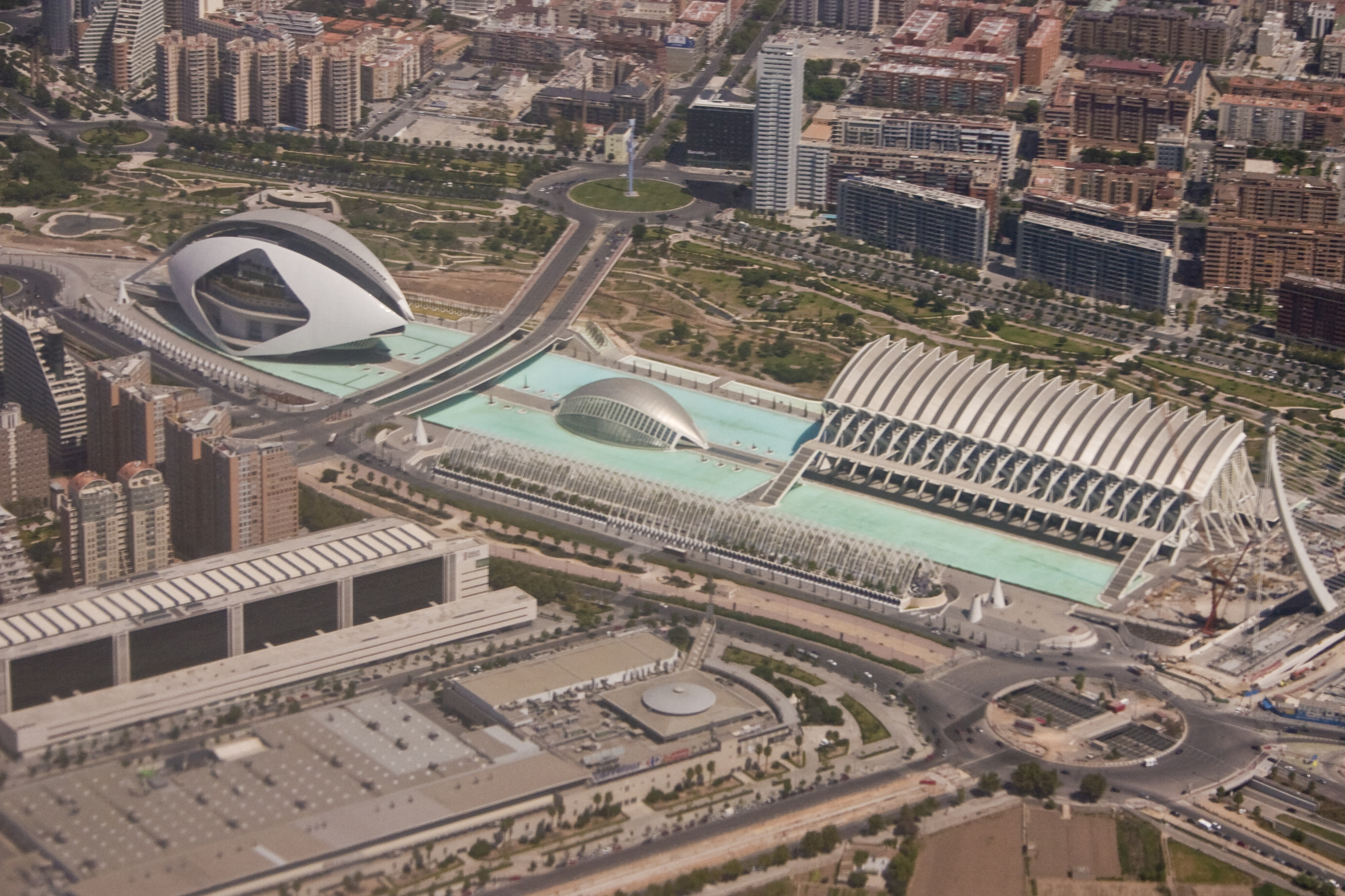 | 2,776 × 1,851 (3.28 MB) | Bha9023 | {{Information |Description={{en|1=An aerial image taken on the EMA to VLC flight path of The Ciutat de les Arts i les Ciències (Valencian), Ciudad de las Artes y las Ciencias (Spanish) or City of Arts and Sciences. The buildings are situated in the Turia |
File usage
The following pages on the English Wikipedia use this file (pages on other projects are not listed):
Global file usage
The following other wikis use this file:
- Usage on ast.wikipedia.org
- Usage on eo.wikipedia.org
- Usage on es.wikipedia.org
- Usage on et.wikipedia.org
- Usage on fr.wikipedia.org
- Usage on he.wikipedia.org
- Usage on ja.wikipedia.org
- Usage on lv.wikipedia.org
- Usage on ms.wikipedia.org
- Usage on ro.wikipedia.org
- Usage on sv.wikipedia.org
- Usage on uk.wikipedia.org