File:Clinton Lake Map.jpg
English | italiano | Nederlands | پښتو | русский | sicilianu | slovenščina | Türkçe | українська | +/−
Original upload log
Transferred from en.wikipedia For the Common Good .
The original description page was
here . All following user names refer to en.wikipedia.
Date/Time
Dimensions
User
Comment
15:08, 13 April 2006
600 × 427 (259,930 bytes)
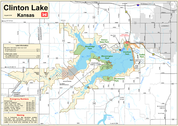
w:en:CharacterZero (talk | contribs )This is a map of the Clinton Lake area in Lawrence, Kansas. It was retrieved from the US Army Corps of Engineers page at: http://www.nwk.usace.army.mil/clinton/clin.html.
English Add a one-line explanation of what this file represents
File history
Click on a date/time to view the file as it appeared at that time.
Date/Time Thumbnail Dimensions User Comment current 03:37, 8 January 2018 600 × 427 (254 KB) Illegitimate Barrister Transferred from en.wikipedia: see original upload log above
File usage
The following pages on the English Wikipedia use this file (pages on other projects are not listed):
Global file usage
The following other wikis use this file:
Usage on fr.wikipedia.org
Usage on it.wikipedia.org
Usage on simple.wikipedia.org
This file contains additional information, probably added from the digital camera or scanner used to create or digitize it.
If the file has been modified from its original state, some details may not fully reflect the modified file.