File:County Of Flanders (topogaphy).png
On this map the red border (Rijks-Vlaanderen - Kroon-Vlaanderen) is missing around the Vier Ambachten.
Click on a date/time to view the file as it appeared at that time.
| Date/Time | Thumbnail | Dimensions | User | Comment | |
|---|---|---|---|---|---|
| current | 22:48, 22 January 2023 | 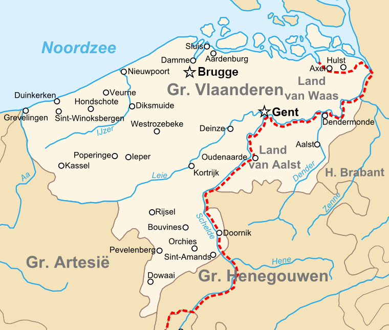 | 760 × 645 (190 KB) | Le Fou | correction |
| 19:35, 10 June 2008 |  | 760 × 645 (207 KB) | Sir Iain | {{Information |Description={{en|1=Topographic map of the en:County of Flanders in the late 14th centry.}} {{nl|1=Topografische kaart van het nl:Graafschap Vlaanderen in de Tweede helft van de 14e eeuw.}} |Source=eigen werk (own work) |Author=[[U |
The following other wikis use this file:
.png)