File:County Of The City Of Dublin 1837 Map.jpg
This is because it is one of the following:
- It is a photograph taken prior to 1 June 1957; or
- It was published prior to 1974; or
- It is an artistic work other than a photograph or engraving (e.g. a painting) which was created prior to 1974.
HMSO has declared that the expiry of Crown Copyrights applies worldwide (ref: HMSO Email Reply)
More information.

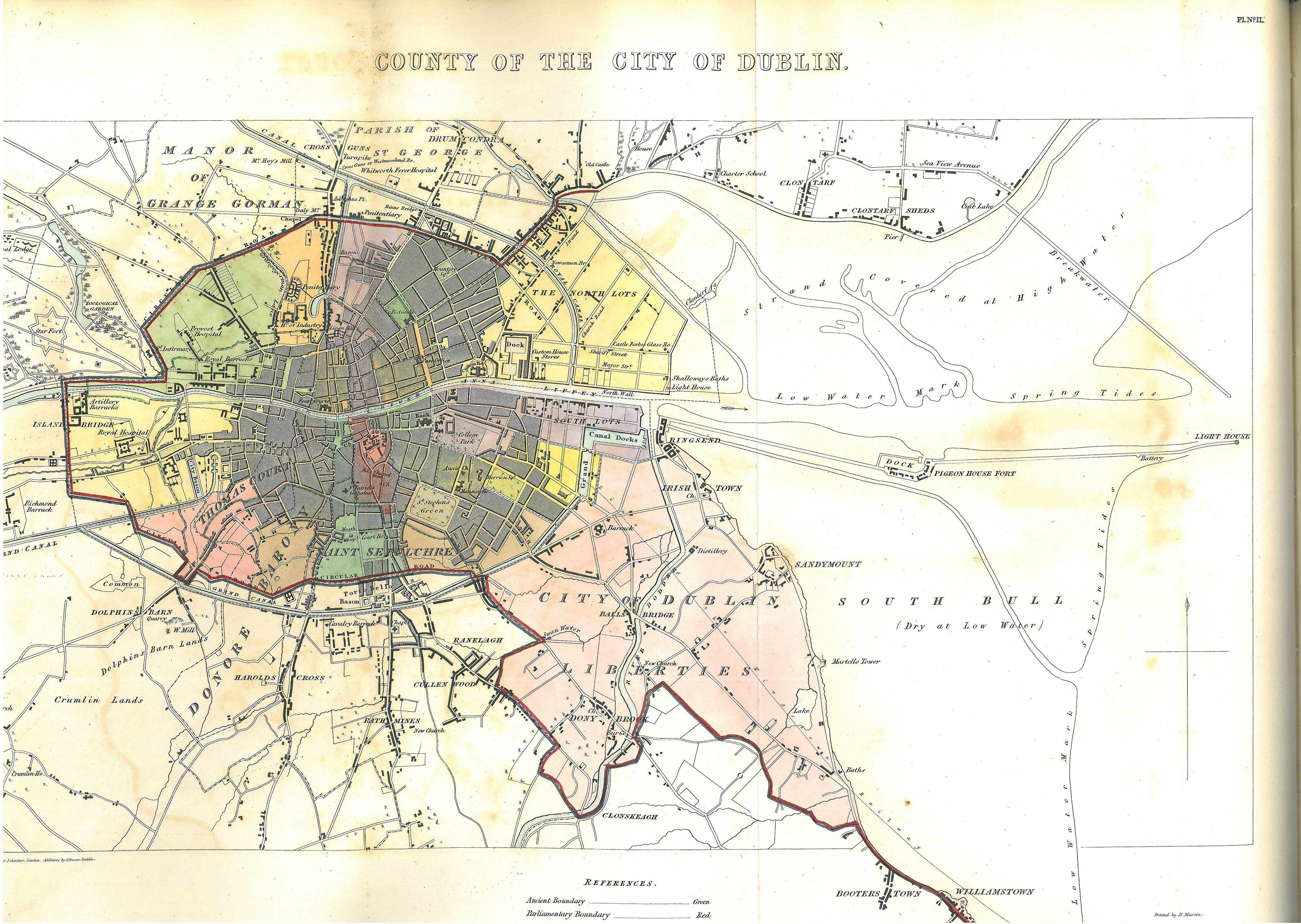
- ↑ HC sessional papers, 10 May 1837 (301) 29 3; Map 2 between pp.60 and 61
- ↑ Commissioners appointed to inquire into the municipal corporations in Ireland (1836) "Appendix II. Manorial Jurisdictions or Liberties." in Appendix to the first report: report on the city of Dublin, Sessional papers, HC 1836 [26] 24 297, H.M. Stationery Office, p. 289, fn "The "liberties of the city," mentioned in the 10 Geo. I. c. 3; 11 Geo. II. c. 11, s. 10; 11 Geo. 11. c. 13, s. 3 ; 11, 12 Geo. III. c. 11, s. 50, and several other Acts, are evidently distinguished from the liberties of St. Sepulchre's, of Thomas Court and Donore, of St. Patrick's, and of Christ Church, which are described as liberties "adjoining" the city."
- ↑ "Dublin [A district, formerly of peculiar jurisdiction, and commonly called the county of the city of Dublin]" in (1846) The Parliamentary Gazetteer of Ireland, II, A. Fullarton, p. 98
- ↑ Lewis, Samuel (1837). Appendix; Shewing the Boundaries of the Cities and Boroughs in Ireland. A Topographical Dictionary of Ireland. ; Commissioners on Boundaries of Cities and Boroughs of Ireland (8 June 1832) "REPORT on the County of the City of Dublin" in Reports from Commissioners and Plans, Sessional papers, HC 1831–32 (519), xliii, 146, pp. 51–56
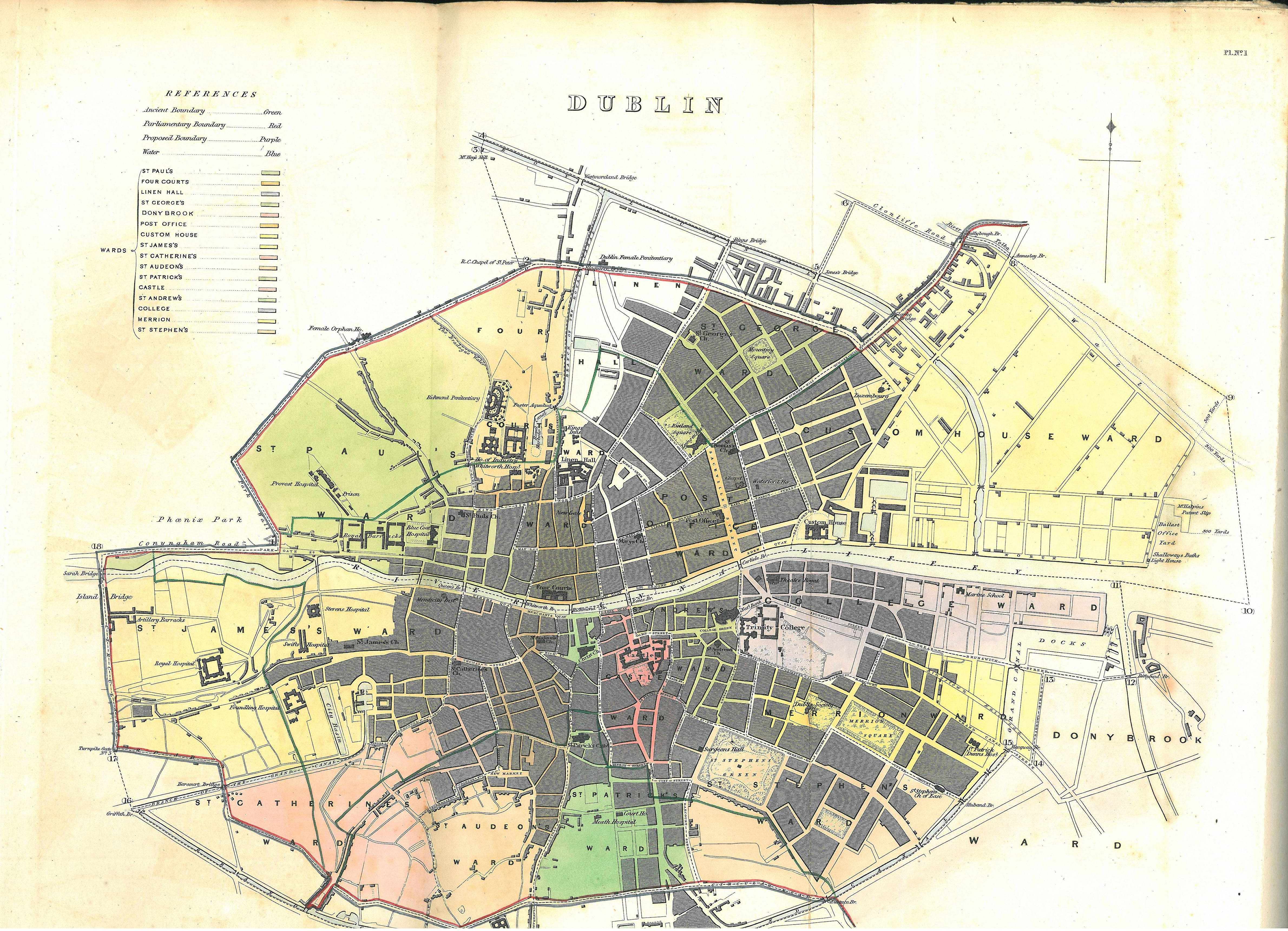
- ↑ HC sessional papers, 10 May 1837 (301) 29 3; Map 1 between pp.60 and 61 for closeup map and pp.64–68 for detail.
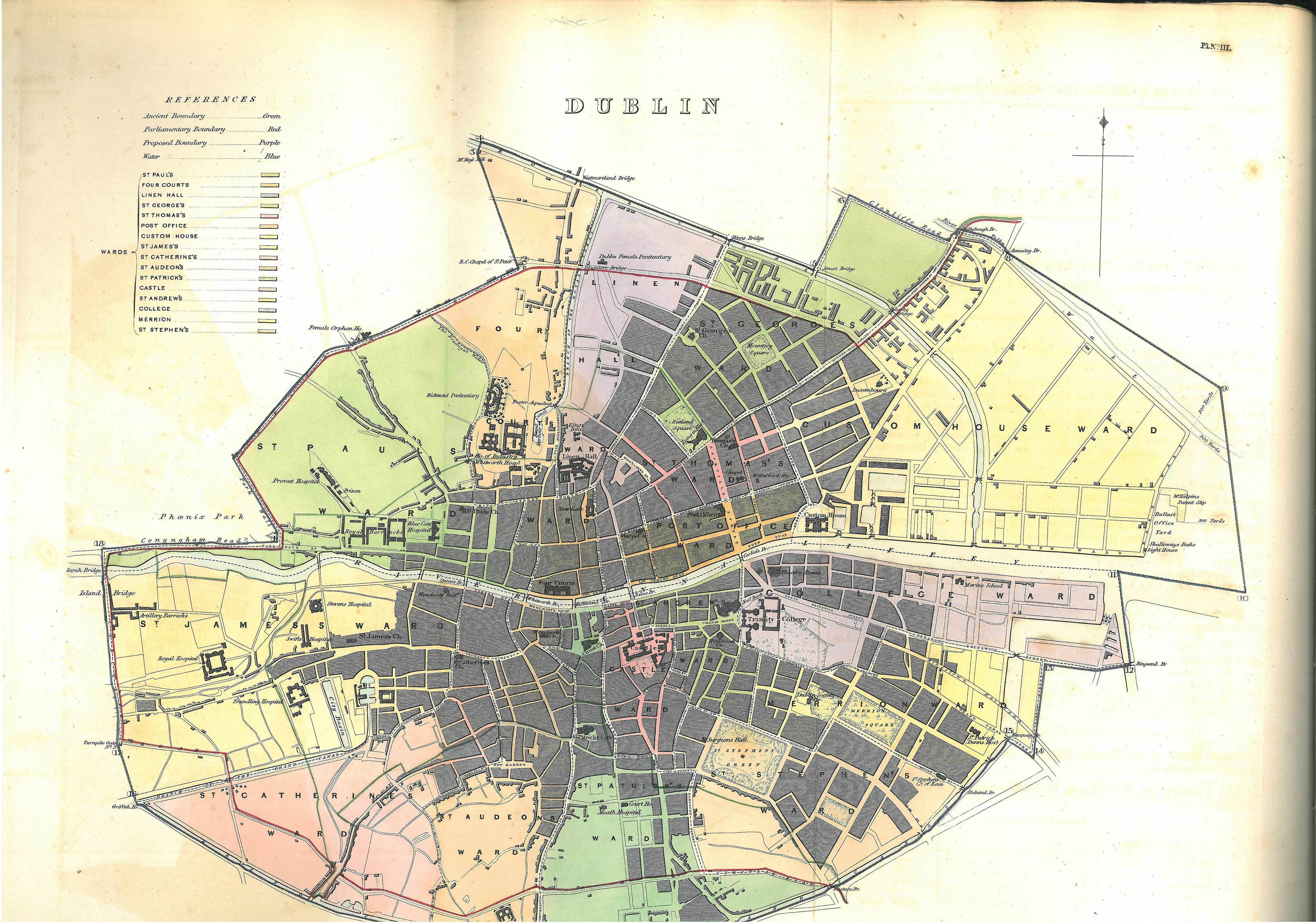
- ↑ HC sessional papers, 10 May 1837 (301) 29 3; Map 3 between pp.60 and 61 for closeup map and pp.69–74 for detail. Compare Index to the Sheets of the Ordnance Map of the City of Dublin (1848).
- ↑ 13 & 14 Victoria c.55
- ↑ 5 & 6 Victoria c.96