File:Crawley Neighbourhoods (West Green).png
Click on a date/time to view the file as it appeared at that time.
| Date/Time | Thumbnail | Dimensions | User | Comment | |
|---|---|---|---|---|---|
| current | 19:31, 22 February 2009 | 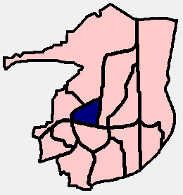 | 260 × 277 (7 KB) | Hassocks5489 | {{Information |Description={{en|1=PNG diagram of the Crawley Borough area (in West Sussex, England), showing the 13 residential neighbourhoods and highlighting West Green in dark blue. (Each neighbourhood was allocated a colour when it was built, which t |
File usage
The following page uses this file:
Global file usage
The following other wikis use this file:
- Usage on nl.wikipedia.org
.png)