Loading
  • 21 Aug, 2019

  • By, Wikipedia

File:Déluge Saguenay Accumulations.png

Captions

Add a one-line explanation of what this file represents

Items portrayed in this file

depicts

14 August 2011

File history

Click on a date/time to view the file as it appeared at that time.

Date/TimeThumbnailDimensionsUserComment
current04:48, 14 August 2011Thumbnail for version as of 04:48, 14 August 2011500 × 609 (206 KB)Pierre cb
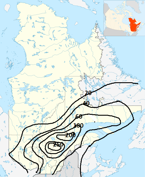
{{Information |Description ={{en|1=Map of rain accumulations from July 18 to 21, 1996, over Quebec province (Canada) during the Saguenay Flood. Maps is done using Canada_Quebec_location_map_2.svg blanck map and dat
The following pages on the English Wikipedia use this file (pages on other projects are not listed):

Global file usage

The following other wikis use this file: