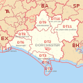
File:DT Postcode Area Map.svg
Indicative postcode districts shown in red, post towns shown in grey.
Equirectangular projection with latitude stretching 160%, WGS84 datum.
Geographic limits:
- Main 1:284,000 map:
- West: 3.06W
- East: 1.988W
- North: 51.104N
- South: 50.434N
Derived from Ordnance Survey OS OpenData.
- Postcode district boundaries within Great Britain derived from Voronoi polygons of OS Code-Point Open unit postcode median coordinates (with coastline clipping and minor adjustments to avoid spurious detached polygons).
- Great Britain coastline, inland water and urban extent data derived from OS Strategi.


