21 Aug, 2019
By, Wikipedia
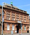
File:Darvel Town Hall (geograph 4027387) (cropped).jpg
Captions
Add a one-line explanation of what this file represents
Click on a date/time to view the file as it appeared at that time.
| Date/Time | Thumbnail | Dimensions | User | Comment | |
|---|---|---|---|---|---|
| current | 18:32, 16 December 2023 |  | 2,986 × 3,456 (4.44 MB) | Bjh21 | Re-cropped from higher-resolution version: File:Darvel Town Hall (geograph 4027387).jpg cropped 42 % horizontally using CropTool with lossless mode. |
| 16:04, 31 July 2022 |  | 459 × 531 (126 KB) | Dormskirk | {{Information |Description =Darvel Town Hall |Source =*File:Darvel Town Hall (geograph 4027387).jpg |Author =Leslie Barrie |Date =31 May 2014 |Permission ={{PD-user|Leslie Barrie}} |other_versions = }} {{RetouchedPicture|cropped|editor=Dormskirk|orig=Darvel Town Hall (geograph 4027387).jpg}} Category:Darvel Town Hall |
The following other wikis use this file: