File:Dorset Map 1834.png
Click on a date/time to view the file as it appeared at that time.
| Date/Time | Thumbnail | Dimensions | User | Comment | |
|---|---|---|---|---|---|
| current | 19:02, 23 February 2013 | 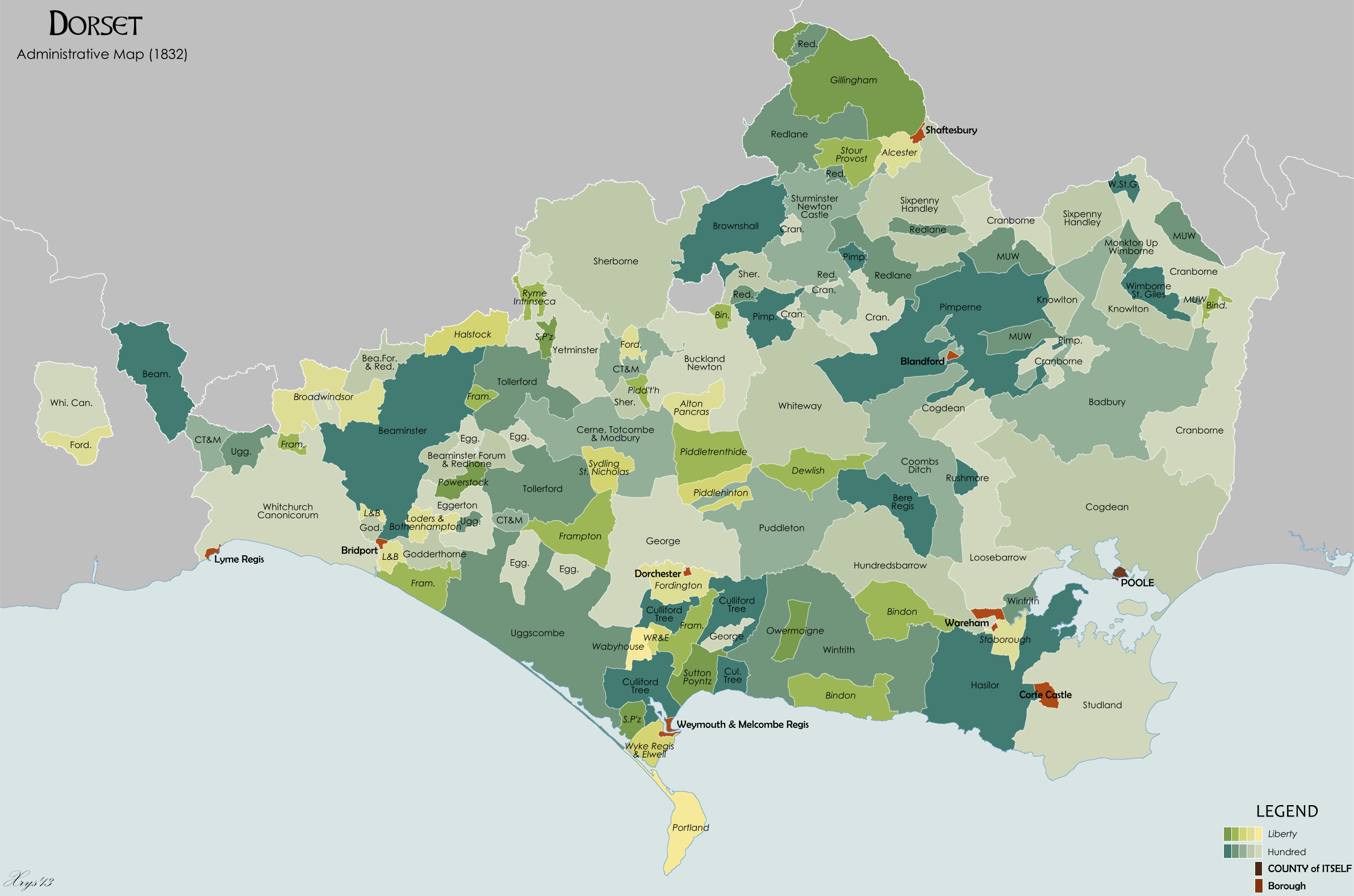 | 2,384 × 1,578 (763 KB) | XrysD | Major revision. Added area transferred to Devon in 1844. Removed areas part of Devon and Somerset until 1844. Hundred and liberty boundaries improved using "Civil Divisions of the County of Dorset, 1833" by Edward Boswell. Also improved by maps of the ... |
| 11:38, 11 October 2010 |  | 2,153 × 1,578 (795 KB) | XrysD | {{Information |Description={{en|1=Administrative map of the ancient county of Dorset in 1834. Showing Liberties, Hundreds and Boroughs. Source data on parish boundaries - Kain, R.J.P., and Oliver, R.R. (2001) "Historic parishes of England and Wales: Elect |
File usage
The following 4 pages use this file:
Global file usage
The following other wikis use this file:
- Usage on ca.wikipedia.org