Click on a date/time to view the file as it appeared at that time.
| Date/Time | Thumbnail | Dimensions | User | Comment |
|---|
| current | 17:31, 3 February 2011 | 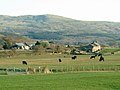 | 640 × 480 (141 KB) | GeographBot | == {{int:filedesc}} == {{Information |description={{en|1=Draenogan Farm Welsh Black cattle grazing}} |date=2007-04-07 |source=From [http://www.geograph.org.uk/photo/398054 geograph.org.uk] |author=[http://www.geograph.org.uk/profile/4632 David Saunders] | |
The following pages on the English Wikipedia use this file (pages on other projects are not listed):
The following other wikis use this file:
- Usage on es.wikipedia.org
- Usage on sr.wikipedia.org
- Usage on uk.wikipedia.org
This file contains additional information, probably added from the digital camera or scanner used to create or digitize it.
If the file has been modified from its original state, some details may not fully reflect the modified file.
