Loading
  • 21 Aug, 2019

  • By, Wikipedia

File:East Galicia And Volhynia 1939.png

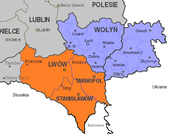
Abbreviations of towns in Volhynia:
W. W.: Włodzimierz Wołyński
Novohrad-V.: Novohrad-Volynskyi
Os.: Ostróg
Staro.: Starokostiantyniv

Krem.: Krzemieniec
Date Source Own work Author Gryffindor Other versions

Licensing

I, the copyright holder of this work, hereby publish it under the following license:
Creative Commons CC-Zero This file is made available under the Creative Commons CC0 1.0 Universal Public Domain Dedication.
The person who associated a work with this deed has dedicated the work to the public domain by waiving all of their rights to the work worldwide under copyright law, including all related and neighboring rights, to the extent allowed by law. You can copy, modify, distribute and perform the work, even for commercial purposes, all without asking permission.

Annotations
InfoField
This image is annotated: View the annotations at Commons

Captions

Add a one-line explanation of what this file represents

Items portrayed in this file

depicts

File history

Click on a date/time to view the file as it appeared at that time.

Date/TimeThumbnailDimensionsUserComment
current12:20, 14 November 2013Thumbnail for version as of 12:20, 14 November 2013600 × 450 (74 KB)Gryffindor{{Information |Description={{en|Map of the south-eastern part of Poland, within the borders of 1921-1939, as well as the eastern part of Volhynia. Highlighted in orange colour are the three Polish voivodeships of Lwów, Stanisławów, and Tarnopol whic...

Global file usage

The following other wikis use this file:

Metadata