File:Edison Sault Power Plant And Soo Locks 2010-04-20 USACE.jpg
| Object location | | View this and other nearby images on: OpenStreetMap |
|---|
| Object location | | View this and other nearby images on: OpenStreetMap |
|---|
Click on a date/time to view the file as it appeared at that time.
| Date/Time | Thumbnail | Dimensions | User | Comment | |
|---|---|---|---|---|---|
| current | 16:25, 3 September 2011 | 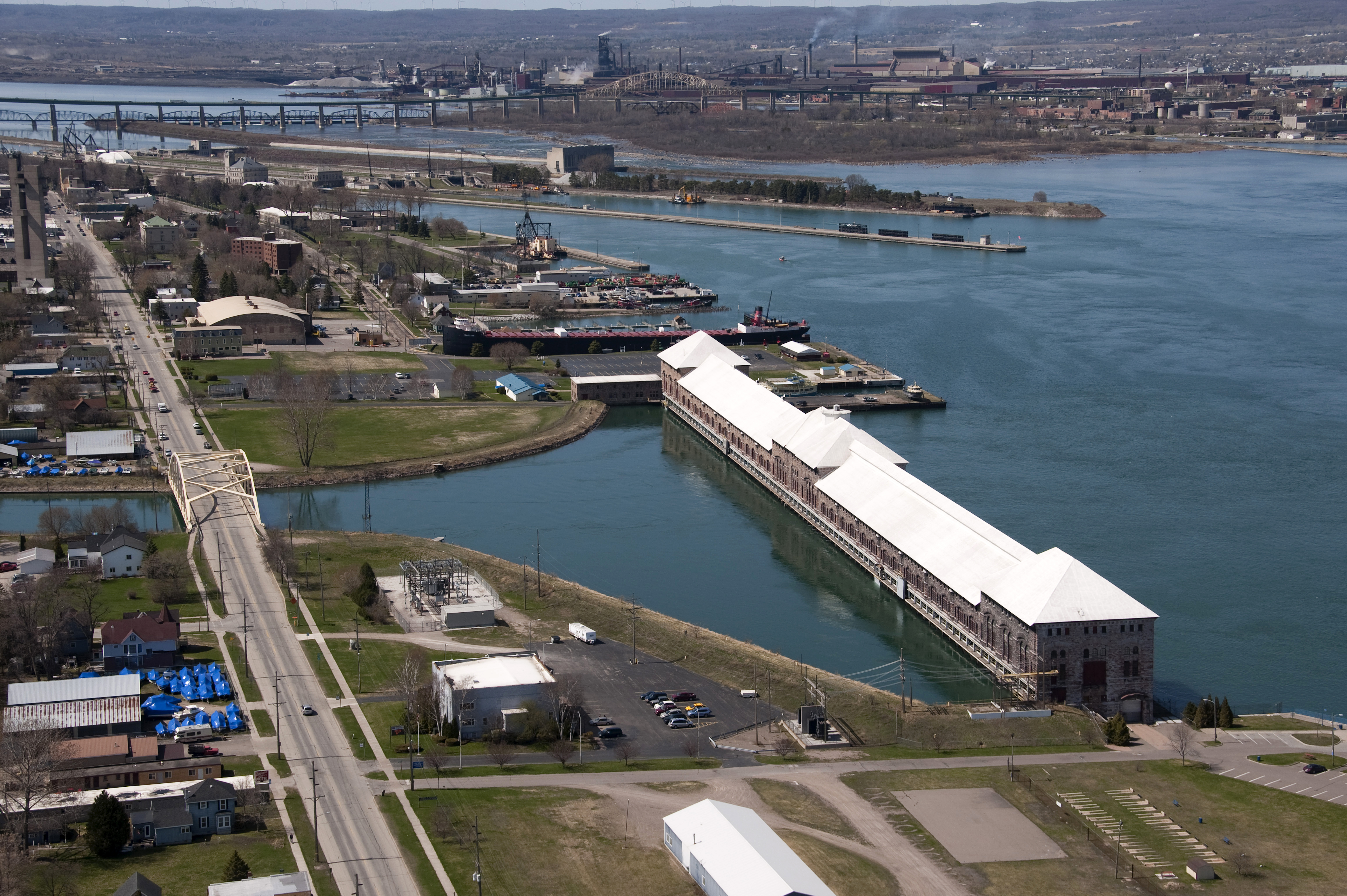 | 6,144 × 4,088 (8.93 MB) | Life of Riley | {{Information |Description={{en|Edison Sault hydroelectric power plant (foreground) and the Soo Locks (background) along the St. Marys River in Sault Ste. Marie, Michigan.}} |Source=US Army Corps of Engineers Digital Visual Library (DVL) [https://eportal. |
The following 2 pages use this file:
The following other wikis use this file: