{{Information
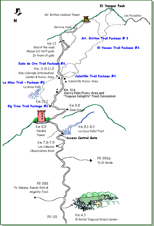
|Description ={{en|1=A map of trails and other locations along [[:en:Puerto Rico Highway 191|Puerto Rico Highway 191]] in [[:en:El Yunque National Forest|El Yunque National Forest]], [[:en:Puerto Rico|Puerto Rico]].}}
|Source =htt
Captions
Add a one-line explanation of what this file represents
Bot: Converting file to superior PNG file. (Source: El_Yunque_Trails_Map.gif). This GIF was problematic due to transparency and non-greyscale color table.
File usage
The following pages on the English Wikipedia use this file (pages on other projects are not listed):