Click on a date/time to view the file as it appeared at that time.
| Date/Time | Thumbnail | Dimensions | User | Comment |
|---|
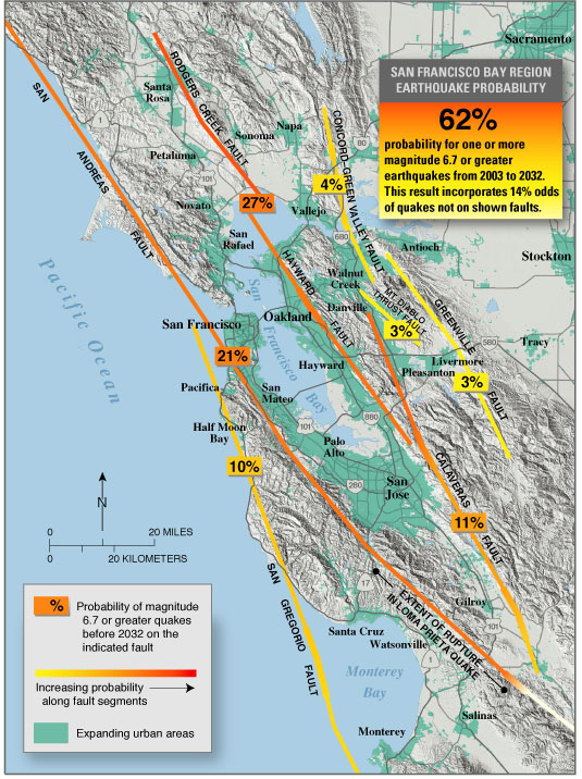
| current | 20:21, 13 May 2008 | 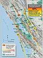 | 535 × 716 (150 KB) | Satipatthana | {{Information |Description={{en|en:USGS seismic hazard map showing the probability of an M6.7 or greater earthquake occurring in the en:San Francisco Bay Area between en:2003 and en:2032. Recent (January 2008) assessments (San Jose Me |
The following other wikis use this file:
- Usage on ar.wikipedia.org
- Usage on de.wikipedia.org
- Usage on en.wikibooks.org
- Usage on es.wikipedia.org
- Usage on gl.wikipedia.org
- Usage on id.wikipedia.org
- Usage on it.wikibooks.org
- Usage on it.wikiversity.org
- Usage on la.wikipedia.org
- Usage on www.wikidata.org
- Usage on zh.wikipedia.org
This file contains additional information, probably added from the digital camera or scanner used to create or digitize it.
If the file has been modified from its original state, some details may not fully reflect the modified file.