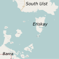
File:Eriskay Map.svg
Click on a date/time to view the file as it appeared at that time.
| Date/Time | Thumbnail | Dimensions | User | Comment | |
|---|---|---|---|---|---|
| current | 09:24, 16 September 2010 |  | 1,180 × 1,178 (235 KB) | Mipmapped | Increased size of labels for major islands. |
| 09:17, 16 September 2010 |  | 1,180 × 1,178 (235 KB) | Mipmapped | {{Information |Description={{en|1=A map of Eriskay and surrounding islands. © OpenStreetMap contributors, CC-BY-SA}} |Source=OpenStreetmap |Author=© OpenStreetMap contributors, CC-BY-SA |Date= |Permission=© OpenStreetMap contributors, CC-BY-SA |other_v |
File usage
The following page uses this file: