File:Europe-slk.svg

[]
-
 dansk
dansk -
 English
 -
 Esperanto
 -
 français
 -
 magyar
 -
 italiano
 -
 norsk
norsk -
 русский
 -
 slovenčina
 -
 svenska
[]


Click on a date/time to view the file as it appeared at that time.
| Date/Time | Thumbnail | Dimensions | User | Comment | |
|---|---|---|---|---|---|
| current | 18:34, 20 May 2018 |  | 506 × 670 (534 KB) | JoKalliauer | https://github.com/JoKalliauer/cleanupSVG 1) sed -i "s/ xlink:href=\"data:;base64,\/9j\/4AAQSkZJRgABAgAAZABkAAD\/7AARRHVja3kAAQAEAAAAHgAA/ xlink:href=\"data:image\/jpeg;base64,\/9j\/4AAQSkZJRgABAgAAZABkAAD\/7AARRHVja3kAAQAEAAAAHgAA/" $i |
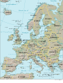
| 11:36, 13 April 2007 |  | 506 × 670 (988 KB) | Helix84 | {{Information |Description={{sk|mapa Európy}} |Source=CIA World Factbook (image), geodesy.gov.sk, Wikipedia (Slovak labels) |Date=13.4.2007 |Author=~~~ |Permission={{PD-self}}{{PD-USGov-CIA-WF}} |other_versions= * Image:Europe.svg (English) * [[:Ima |