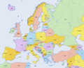
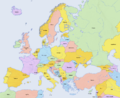
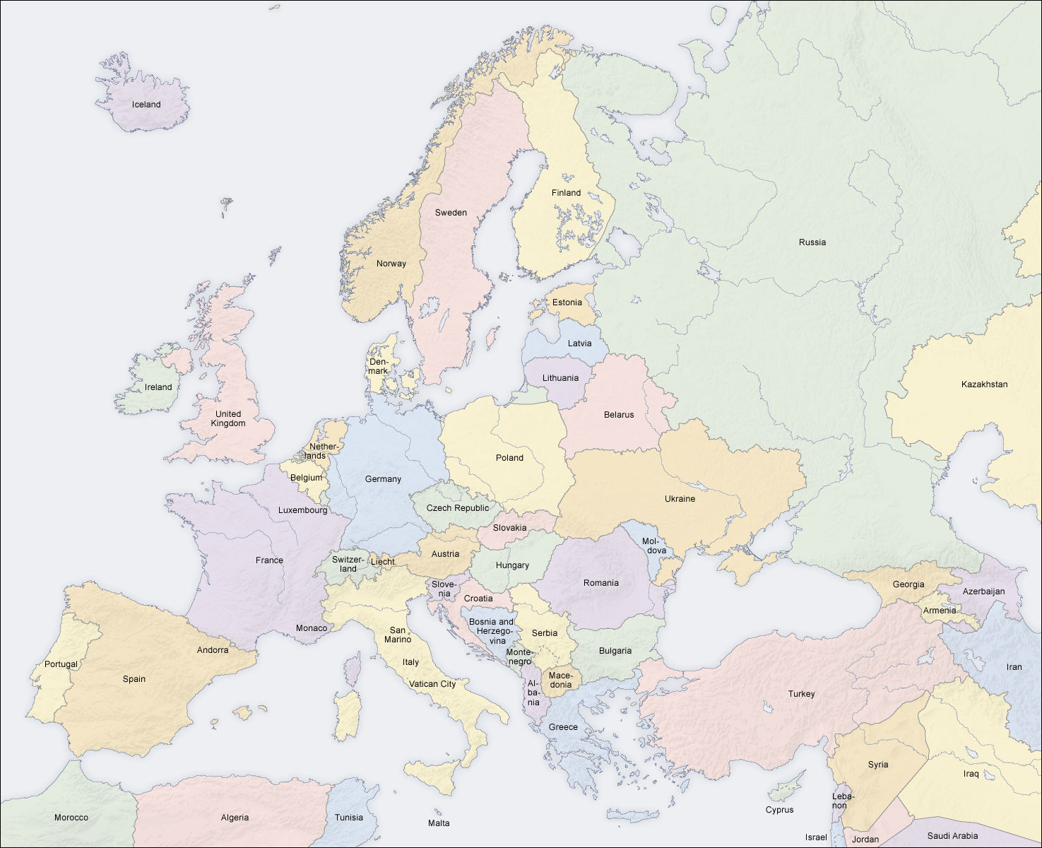
File:Europe Countries Map En.png

|
Permission is granted to copy, distribute and/or modify this document under the terms of the GNU Free Documentation License, Version 1.2 or any later version published by the Free Software Foundation; with no Invariant Sections, no Front-Cover Texts, and no Back-Cover Texts. A copy of the license is included in the section entitled GNU Free Documentation License. |
| This file is licensed under the Creative Commons Attribution-Share Alike 3.0 Unported license. | ||
| ||
| This licensing tag was added to this file as part of the GFDL licensing update. |
Derivative works of this file:
[]
-
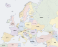
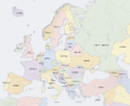
 plain map (without text)
 -
 plain map (without text, retouch)
 -
 local language
 -
 local language (retouch)
 -
 Afrikaans
 -
 bosanski
 -
 čeština
 -
 čeština 2
 -
 Deutsch
 -
 Deutsch 2
 -
 dolnoserbski
 -
 eesti
eesti -
 English
 -
 English 2
 -
 Esperanto
 -
 español
 -
 føroyskt
 -
 français
 -
 français 2
 -
 Gàidhlig
 -
 hornjoserbsce
 -
 hrvatski
 -
 italiano
 -
 italiano 2
 -
 Latina
 -
 lietuvių
 -
 latviešu
 -
 magyar
 -
 Nāhuatl
 -
 Nāhuatl 2
 -
 polski
 -
 shqip
shqip -
 slovenčina
 -
 slovenščina
 -
 ślůnski
 -
 ślůnski 2
 -
 Türkçe
 -
 Wolof
Wolof -
 български
 -
 монгол
 -
 македонски
 -
 русский
 -
 српски (ћирилица)
 -
 тоҷикӣ
 -
 українська
 -
 ქართული
 -
 ភាសាខ្មែរ
 -
 ភាសាខ្មែរ 2
 -
 𐌲𐌿𐍄𐌹𐍃𐌺
 -
 日本語
日本語 -
 日本語 2
日本語 2 -
 文言
文言 -
 العربية


|
This map of europe image could be re-created using vector graphics as an SVG file. This has several advantages; see Commons:Media for cleanup for more information. If an SVG form of this image is available, please upload it and afterwards replace this template with
{{vector version available|new image name}}.
It is recommended to name the SVG file “Europe countries map en.svg”—then the template Vector version available (or Vva) does not need the new image name parameter. |


_en.png)
.png)
.jpg)