File:Europe Laea Location Map.svg
Own work
Author
Alexrk2
Other versions
SVG development
- Data from/Données issues de http://naturalearthdata.com/, Scale: 1:10 Mio
Derivative works of this file:
- England location map.svg
- EuroVelo Route 6 map.svg
- Myotis alcathoe range.svg
- Bulgaro stati giuridici.png
- Europe laea topography.svg
[]
-
 Blank political map
 -
 Political map with state boundaries, inland water and rivers
 -
 European Union
 -
 NATO members
 -
 European countries
 -
 Physical map
 -
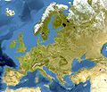
 Physical map with land cover
 -
 Bluemarble
 -
 Before 1990


.svg)


|
This map has been made or improved in the German Kartenwerkstatt (Map Lab). You can propose maps to improve as well.
|
Licensing
I, the copyright holder of this work, hereby publish it under the following license:
This file is licensed under the Creative Commons Attribution-Share Alike 3.0 Unported license.
- You are free:
- to share – to copy, distribute and transmit the work
- to remix – to adapt the work
- Under the following conditions:
- attribution – You must give appropriate credit, provide a link to the license, and indicate if changes were made. You may do so in any reasonable manner, but not in any way that suggests the licensor endorses you or your use.
- share alike – If you remix, transform, or build upon the material, you must distribute your contributions under the same or compatible license as the original.


