File:FilchnerRonne Map.png
Click on a date/time to view the file as it appeared at that time.
| Date/Time | Thumbnail | Dimensions | User | Comment | |
|---|---|---|---|---|---|
| current | 10:20, 9 July 2011 |  | 235 × 289 (26 KB) | Grutness | as before - tidied |
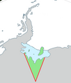
| 10:18, 9 July 2011 |  | 283 × 334 (31 KB) | Grutness | Outline map showing the Filchner-Ronne Ice Shelf and the unnamed sector of Antarctica lying to its south, between Ellsworth Land (at 80°W) and Coats Land (at 36°W). Generated from File:Antarctica,_territorial_claims.svg ({{cc-by-sa-2.5|[[:User: |
File usage
The following pages on the English Wikipedia use this file (pages on other projects are not listed):
- Carlson Inlet
- Coal Rock
- Doake Ice Rumples
- Edith Ronne Land
- Fletcher Ice Rise
- Forlidas Pond
- Fowler Ice Rise
- Gambacorta Peak
- Gould Bay
- Grand Chasms
- Hemmen Ice Rise
- Henry Ice Rise
- Hercules Inlet
- Iceberg A-76
- Institute Ice Stream
- Kershaw Ice Rumples
- Korff Ice Rise
- McCarthy Inlet
- Möller Ice Stream
- Roberts Inlet
- Ruthven Bluff
- South Ice
- Spilhaus Inlet
- Template:QueenElizabethLand-geo-stub