File:Fort Worth Bank One Building Damage Edited.jpg
| Camera location | | View this and other nearby images on: OpenStreetMap |
|---|
| Camera location | | View this and other nearby images on: OpenStreetMap |
|---|
Click on a date/time to view the file as it appeared at that time.
| Date/Time | Thumbnail | Dimensions | User | Comment | |
|---|---|---|---|---|---|
| current | 03:13, 30 June 2009 | 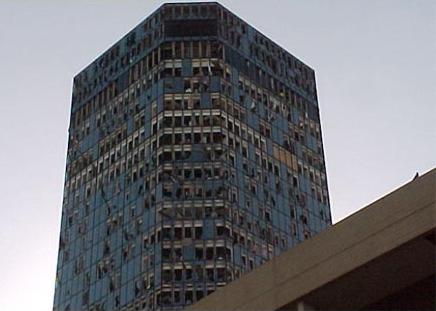 | 436 × 311 (31 KB) | Runningonbrains | {{Information |Description={{en|1=Damage to the Bank One Building (now known as The Tower) in downtown w:Fort Worth, Texas from the w:2000 Fort Worth tornado. Image edited from [http://www.fema.gov/graphics/plan/prevent/saferoom/texast4.jpeg the |
The following 4 pages use this file:
The following other wikis use this file: