File:France Pays Bretons Map.svg
Derivative works of this file: Bretagne historic location map.svg
[]
-
 français, JPG
 -
 français, JPG
 -
 brezhoneg, SVG
 -
 français, PNG
 -
 русский, SVG


This vector image was created with Inkscape .

|
This SVG file contains embedded text that can be translated into your language, using any capable SVG editor, text editor or the SVG Translate tool. For more information see: About translating SVG files. |
Original upload log
This image is a derivative work of the following images:
- File:France_Pays_bretons_map.jpg licensed with Cc-by-sa-3.0,2.5,2.0,1.0, GFDL
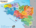
- 2010-03-31T12:59:09Z Pethrus 1500x1189 (835023 Bytes) {{Information |Description={{en|Map of the traditionnal regions of Bretagne (France)}}{{fr|Carte des pays traditionnels bretons}} |Source=[http://www.geobreizh.com www.geobreizh.com], Mikael Bodlore-Penlaez |Date=2010-03-30 |
Uploaded with derivativeFX


