File:Fula Jihad States Map General C1830.png
In case this is not legally possible:
T L Miles grants anyone the right to use this work for any purpose, without any conditions, unless such conditions are required by law.
T L Miles grants anyone the right to use this work for any purpose, without any conditions, unless such conditions are required by law.
Original upload log
The original description page was here. All following user names refer to en.wikipedia.
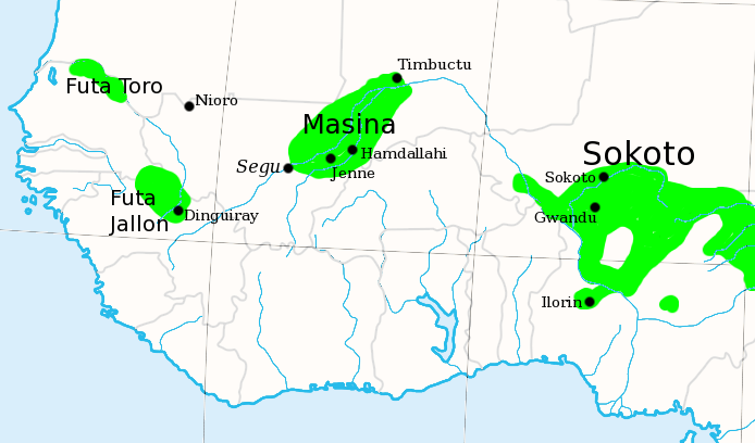
- 2007-07-06 20:07 T L Miles 694×408×8 (96623 bytes) I made this, using the commons' [[Image:Africa_map_blank.svg]] as a template. Shows the major Fula / Fulani /Peul Jihad states of West Africa, circa 1830, prior to the rise of Umar Tall.