File:GermanAustriaMap.png
Please provide a meaningful description of this file.

|
This map has been uploaded by Electionworld from en.wikipedia.org to enable the |
Areas 3 and 4 are transposed: Sudetenland is the area shown West and Silesia in the East
| This work has been released into the public domain by its author, AjaxSmack. This applies worldwide. In some countries this may not be legally possible; if so: |
Click on a date/time to view the file as it appeared at that time.
| Date/Time | Thumbnail | Dimensions | User | Comment | |
|---|---|---|---|---|---|
| current | 20:05, 16 July 2021 | 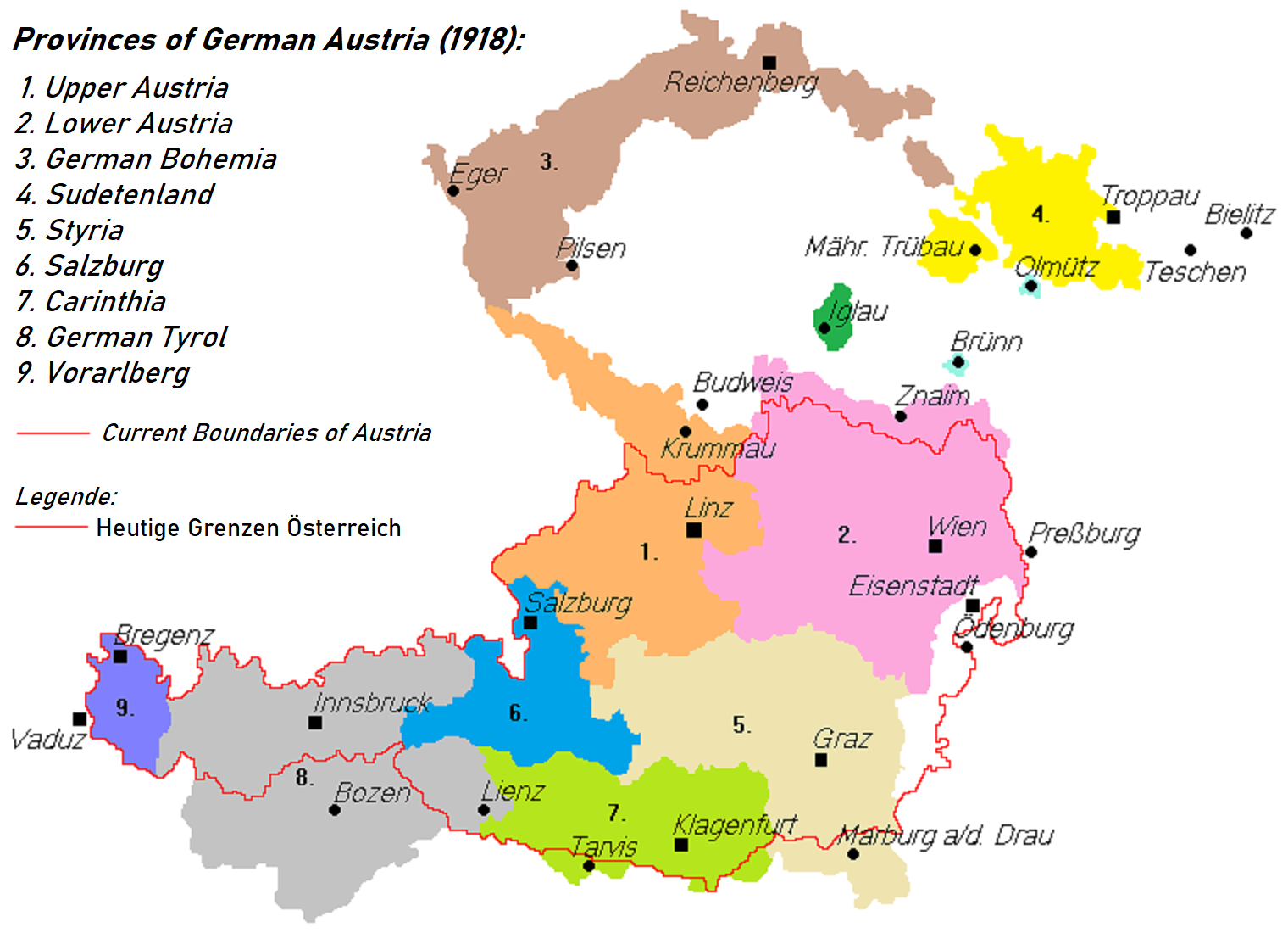 | 1,520 × 1,100 (285 KB) | Kontrollstellekundl | brighter colours, better resolution |
| 02:15, 28 July 2018 |  | 788 × 560 (27 KB) | AjaxSmack | Reverted to version as of 07:16, 16 June 2017 (UTC); note text at de:Datei:Deutschösterreich.PNG | |
| 20:42, 24 December 2017 |  | 788 × 560 (27 KB) | Mélomène | Colors | |
| 07:16, 16 June 2017 |  | 788 × 560 (27 KB) | Valdemar | Reichenberg is really cs:Liberec | |
| 21:43, 17 February 2014 |  | 788 × 560 (23 KB) | Kirk979 | correction | |
| 21:23, 17 February 2014 |  | 788 × 560 (20 KB) | Kirk979 | correction | |
| 15:50, 29 December 2011 |  | 788 × 560 (31 KB) | Fext | Fixed location of Reichenberg (Liberec) | |
| 22:49, 23 December 2006 |  | 788 × 560 (23 KB) | Electionworld | {{ew|en|AjaxSmack}} == Summary == Based on: de:Bild:Deutschösterreich.PNG == Licensing == {{PD-user|AjaxSmack}} |
The following 12 pages use this file:
The following other wikis use this file:
View more global usage of this file.