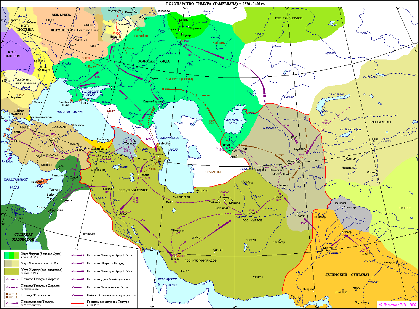
File:Golden Horde 1389.svg
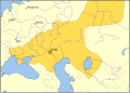
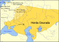
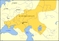
The domains of the Golden Horde in the year 1389, before the Tokhtamysh-Timur war. The rivers are shown in blue, the 2006 international borders in light brown, and important cities of 1389 with a black circle. The capital of the Golden Horde, Sarai is shown with a gold star. Kiev, Moscow, Novgorod and Vilnius are shown as circles.
This map uses a Lambert azimuthal equal-area projection.
Date
Source
Author
MapMaster
Other versions
SVG development 

Own work. Sources used in creating this map:
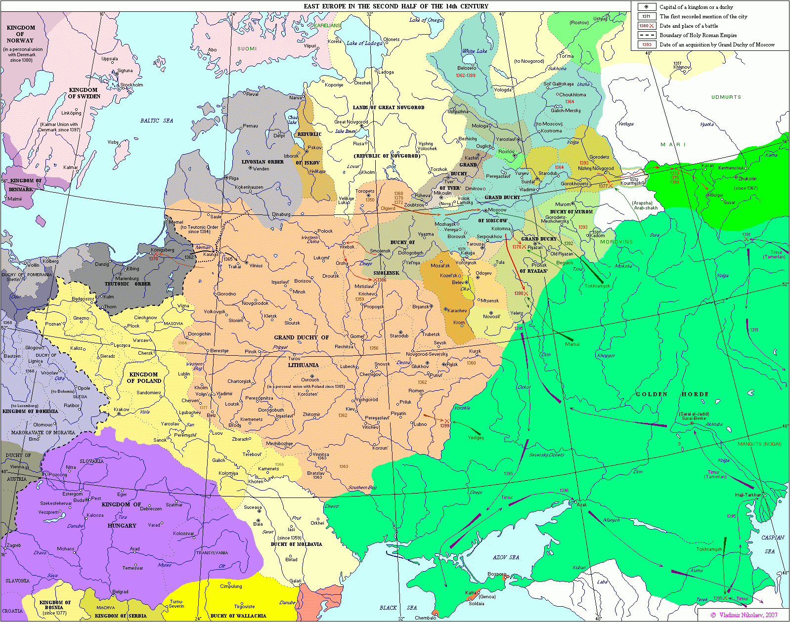
- Project "Geosynchrony: Atlas of World History", western borders: Nikolaev V.V. (2007) East Europe in the second half of the XIV century; eastern borders: Nikolaev V.V. (2003) Timur's state in 1370-1405.
- Morgan, David (1986) The Mongols, Butler & Tanner, Frome, Somerset.
- This map from Shepherd, William (1911) Historical Atlas, Henry Holt and Company, New York.
- plus a review of the Tatar Encyclopedia.
[]
-
 English
 -
 español
 -
 português
 -
 Ελληνικά
 -
 русский
 -
 српски (ћирилица)
 -
 עברית
עברית -
 العربية
 -
 Türkçe


Licensing
I, the copyright holder of this work, hereby publish it under the following license:

|
Permission is granted to copy, distribute and/or modify this document under the terms of the GNU Free Documentation License, Version 1.2 or any later version published by the Free Software Foundation; with no Invariant Sections, no Front-Cover Texts, and no Back-Cover Texts. A copy of the license is included in the section entitled GNU Free Documentation License. |
| This file is licensed under the Creative Commons Attribution-Share Alike 3.0 Unported license. | ||
| ||
| This licensing tag was added to this file as part of the GFDL licensing update. |


