File:Greater Amwell And Sourland Region.png
- Map is oriented north-up and is ~19.5 miles east to west.
- Created by tiling nine topographic maps of the Amwell Valley-Sourlands Region and tracing contours at 100-ft intervals.
| I, the copyright holder of this work, release this work into the public domain. This applies worldwide. In some countries this may not be legally possible; if so: I grant anyone the right to use this work for any purpose, without any conditions, unless such conditions are required by law. |
Click on a date/time to view the file as it appeared at that time.
| Date/Time | Thumbnail | Dimensions | User | Comment | |
|---|---|---|---|---|---|
| current | 19:26, 31 December 2011 | 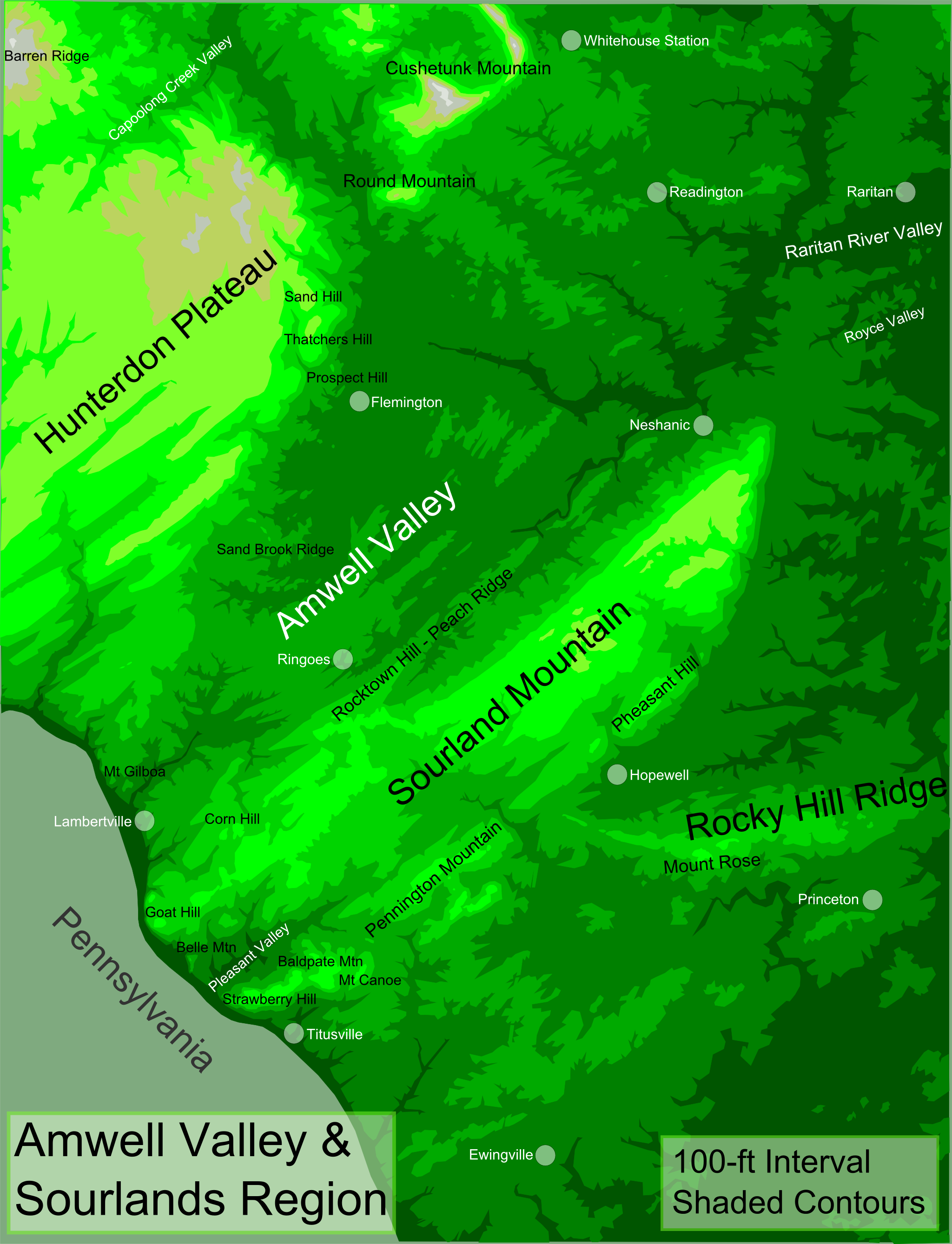 | 2,048 × 2,677 (1.03 MB) | Lithium6ion | {{Information |Description ={{en|1=The map above uses shaded contours at 100-ft intervals to depict topography. Legend:<br> Darkest Green = 0-100 ft<br> Dark Green = 100-200 ft<br> Medium Green = 200-300 ft<br> Light Green = 300-400 ft<br> Lightest Gre |
The following other wikis use this file: