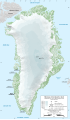
File:Greenland Ice Sheet AMSL Thickness Map-en.png
Own work
Author
Eric Gaba (Sting - fr:Sting)
Permission
(Reusing this file)
Other versions
- Sources used:
- NGDC ETOPO1 (public domain)
- Location of GISP2 drill: NCDC/NOAA
- NGDC ETOPO1 (public domain)
(Reusing this file)
| Attribution and Share-Alike required |
|---|
| Any use of this map can be made as long as you credit me (Eric Gaba – Wikimedia Commons user: Sting) as the author and distribute the copies and derivative works under the same license(s) that the one(s) stated below. A message with a reply address would also be greatly appreciated. |
[]
-
 English (SVG)
 -
 English (PNG)
 -
 French (PNG)
 -
 Georgian
 -
 Macedonian
 -
 Polish


| Camera location | | View this and other nearby images on: OpenStreetMap |
|---|
Licensing
Eric Gaba (Wikimedia Commons user Sting), the copyright holder of this work, hereby publishes it under the following license:
This file is licensed under the Creative Commons Attribution-Share Alike 3.0 Unported license.
Attribution: Eric Gaba (Wikimedia Commons user Sting)
- You are free:
- to share – to copy, distribute and transmit the work
- to remix – to adapt the work
- Under the following conditions:
- attribution – You must give appropriate credit, provide a link to the license, and indicate if changes were made. You may do so in any reasonable manner, but not in any way that suggests the licensor endorses you or your use.
- share alike – If you remix, transform, or build upon the material, you must distribute your contributions under the same or compatible license as the original.

