Click on a date/time to view the file as it appeared at that time.
| Date/Time | Thumbnail | Dimensions | User | Comment |
|---|
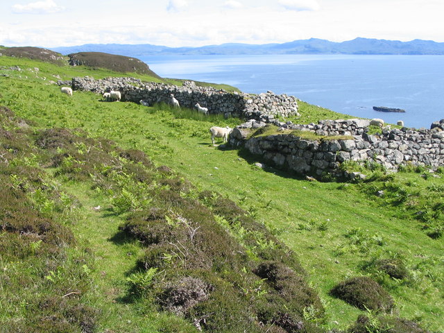
| current | 15:05, 4 February 2011 |  | 640 × 480 (130 KB) | GeographBot | == {{int:filedesc}} == {{Information |description={{en|1=Grulin Iochdrach Ruins of the township at Grulin Iochdrach. 14 families were cleared from Grulin in 1853 to make way for sheep. Most emigrated to Nova Scotia.}} |date=2004-06-22 |source=From [http:/ |
The following pages on the English Wikipedia use this file (pages on other projects are not listed):
This file contains additional information, probably added from the digital camera or scanner used to create or digitize it.
If the file has been modified from its original state, some details may not fully reflect the modified file.