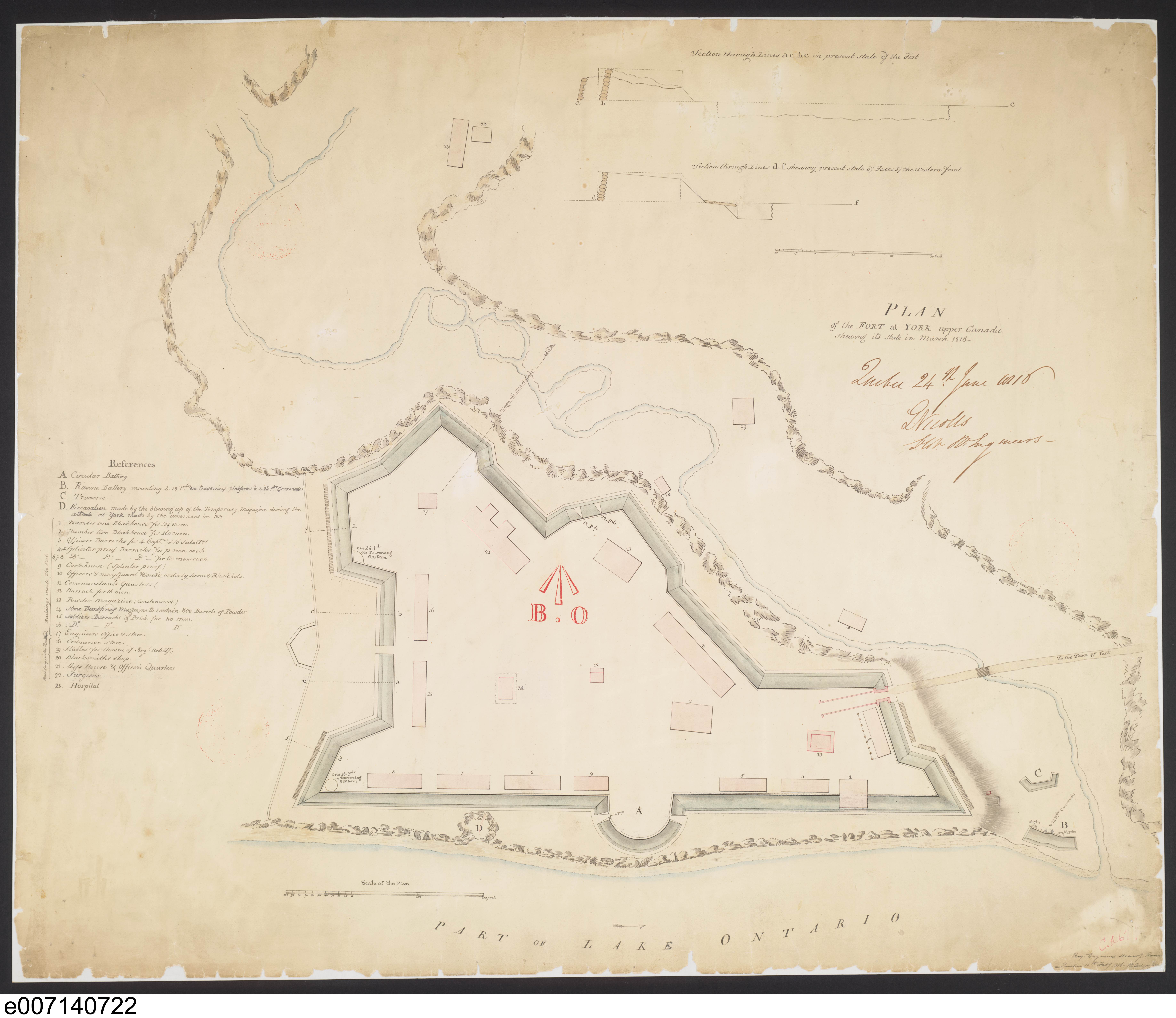
Note the defensive position of the fort, which was located on a bluff above the lakeshore and protected by Garrison Creek ravine. Later fill has extended the shore and changed the surrounding topography.
The crater at the lakeshore caused by the explosion of the powder magazine in 1813 is marked by 'D'. ”
- Isobel Ganton & Joan Winearls, MAPPING TORONTO'S FIRST CENTURY 1787-1884
This Canadian work is in the public domain in Canada because its copyright has expired due to one of the following:
1. it was subject to Crown copyright and was first published more than 50 years ago, or
it was not subject to Crown copyright, and
2. it is a photograph that was created prior to January 1, 1949, or
3. the creator died prior to January 1, 1972.
You must also include a United States public domain tag to indicate why this work is in the public domain in the United States.
Note that this work might not be in the public domain in countries that do not apply the rule of the shorter term and have copyright terms longer than life of the author plus 50 years. In particular, Mexico is 100 years, Jamaica is 95 years, Colombia is 80 years, Guatemala and Samoa are 75 years, Switzerland and the United States are 70 years, and Venezuela is 60 years.
{{Information |Description={{en|1=“After the War of 1812, Fort York was rebuilt to provide quarters for 950 men within a defensive wall. Today’s Old Fort York reconstructs the fort of this period. Note the defensive position of the fort, which was located on a bluff above the lakeshore and protected by Garrison Creek ravine. Later fill has extended the shore and changed the surrounding topography. The crater at the lakeshore caused by the explosion of the powder magazine in 1813 is marked b...
File usage
The following pages on the English Wikipedia use this file (pages on other projects are not listed):

