File:Gwinnett County Airport From Hosea Road.jpg
http://creativecommons.org/publicdomain/zero/1.0/deed.enCC0Creative Commons Zero, Public Domain Dedicationfalsefalse
Add a one-line explanation of what this file represents
Click on a date/time to view the file as it appeared at that time.
| Date/Time | Thumbnail | Dimensions | User | Comment |
|---|
| current | 13:57, 19 January 2022 | 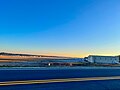 | 4,032 × 3,024 (2.69 MB) | Northwalker | {{Information |Description=Gwinnett County Airport, seen from Hosea Road (looking east) |Source={{own}} |Date= |Author= Northwalker |Permission= |other_versions= }} {{Location dec|33.9719711921537|-83.97339884009078}} Category:Gwinnett County Airport |
The following page uses this file:
