File:Han Map.jpg
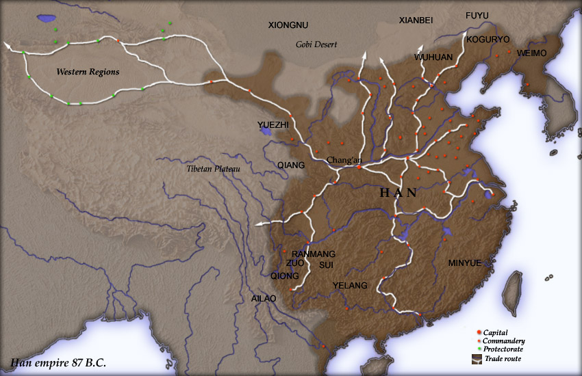
Map of en:Han Dynasty empire 87 BC, showing the capital en:Chang'an and the location of all en:commandery seats. In the Western Regions, a number of pretectorates were Han vassals and under the nominal authority of the Chief Protector of the Western Regions appointed by the Han court.
en:Category:Maps of the history of China
Source
Created and copyright (2004) by Yuninjie. Released under the GNU FDL. The northern border is the line of the en:Qin Dynasty en:Great Wall. Trade routes are generally based on the work of en:Joseph Needham. Selected non-Chinese peoples are also shown.
Author
User Yuninjie on en.wikipedia
Permission
(Reusing this file)
Released under the GNU Free Documentation License.
Other versions
(Reusing this file)
Originally from en.wikipedia; description page is (was) here
* 00:02, 6 November 2004 [[:en:User:Yuninjie|Yuninjie]] 850×550 (154,737 bytes) <span class="comment">(Map of Han empire 87 BC)</span>

|
Permission is granted to copy, distribute and/or modify this document under the terms of the GNU Free Documentation License, Version 1.2 or any later version published by the Free Software Foundation; with no Invariant Sections, no Front-Cover Texts, and no Back-Cover Texts. A copy of the license is included in the section entitled GNU Free Documentation License. |
| This file is licensed under the Creative Commons Attribution-Share Alike 3.0 Unported license. | ||
| ||
| This licensing tag was added to this file as part of the GFDL licensing update. |
(Uploaded using CommonsHelper or PushForCommons)

