File:Helmand Districts.png
Click on a date/time to view the file as it appeared at that time.
| Date/Time | Thumbnail | Dimensions | User | Comment | |
|---|---|---|---|---|---|
| current | 14:10, 15 February 2024 | 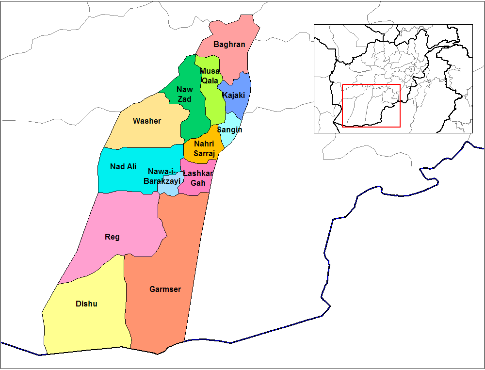 | 1,000 × 763 (32 KB) | User-duck | Cropped 5 % horizontally, 6 % vertically using CropTool with lossless mode. |
| 14:09, 15 February 2024 |  | 1,056 × 816 (32 KB) | User-duck | Reverted to version as of 19:24, 29 March 2007 (UTC)recrop | |
| 13:53, 15 February 2024 |  | 1,000 × 762 (32 KB) | User-duck | Cropped 5 % horizontally, 7 % vertically using CropTool with lossless mode. | |
| 19:24, 29 March 2007 |  | 1,056 × 816 (32 KB) | Rarelibra | Map of the districts of Helmand province of Afghanistan. Created by ~~~~ for public domain use, using MapInfo Professional v8.5 and various mapping resources. |
File usage
The following pages on the English Wikipedia use this file (pages on other projects are not listed):
Global file usage
The following other wikis use this file:
- Usage on ar.wikipedia.org
- Usage on bn.wikipedia.org
- Usage on ca.wikipedia.org
- Usage on ceb.wikipedia.org
- Usage on da.wikipedia.org
- Usage on de.wikipedia.org
- Usage on en.wikinews.org
- Usage on eo.wikipedia.org
- Usage on es.wikipedia.org
- Usage on fa.wikipedia.org
- Usage on fr.wikipedia.org
- Usage on he.wikipedia.org
- Usage on hu.wikipedia.org
- Usage on it.wikipedia.org
- Usage on it.wikinews.org
- Usage on ja.wikipedia.org
- Usage on lt.wikipedia.org
- Usage on mn.wikipedia.org
- Usage on ms.wikipedia.org
- Usage on nl.wikipedia.org
- Usage on no.wikipedia.org
- Usage on pl.wikipedia.org
- Usage on pl.wikinews.org
- 2009-05-15: Afganistan: starcia w prowincji Helmand - zginęli talibowie i Brytyjczyk
- 2009-07-03: Helmand: na polu walk poległ Amerykanin oraz dwoje Brytyjczków
- 2009-07-17: Operacje w prowincji Helmand - bieżąca sytuacja
- 2010-02-13: Afganistan: alianci rozpoczęli szturm na talibską twierdzę
- 2010-02-14: Helmand: trwają ciężkie walki z talibami - raport z pierwszego dnia operacji Musztarak
- 2010-02-15: Helmand: trwają ciężkie walki z talibami - raport z drugiego dnia operacji Musztarak
View more global usage of this file.