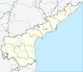
File:India Andhra Pradesh Location Map (current).svg
Click on a date/time to view the file as it appeared at that time.
| Date/Time | Thumbnail | Dimensions | User | Comment | |
|---|---|---|---|---|---|
| current | 10:19, 7 April 2022 |  | 1,027 × 849 (358 KB) | C1MM | Updated districts |
| 16:27, 28 December 2021 |  | 1,027 × 849 (457 KB) | C1MM | Updated rivers | |
| 05:20, 7 June 2021 |  | 1,027 × 849 (511 KB) | C1MM | c rivers and borders | |
| 04:41, 28 June 2020 |  | 1,454 × 1,202 (963 KB) | C1MM | Fixed rivers | |
| 23:39, 25 April 2020 |  | 2,716 × 2,348 (1,003 KB) | C1MM | Relayered | |
| 22:51, 25 April 2020 |  | 2,716 × 2,348 (613 KB) | C1MM | Fixed rivers | |
| 21:36, 21 April 2020 |  | 2,716 × 2,348 (531 KB) | C1MM | Separated Yanam | |
| 21:28, 21 April 2020 |  | 2,716 × 2,348 (529 KB) | C1MM | Added new borders | |
| 03:11, 23 June 2016 |  | 2,716 × 2,348 (314 KB) | Milenioscuro | User created page with UploadWizard |
File usage
More than 100 pages use this file. The following list shows the first 100 pages that use this file only. A full list is available.
- Adoni
- Ahobilam
- Allur, Nellore district
- Amalapuram
- Anantapur
- Annavaram
- Antarvedi
- Araku Valley
- Arasavalli
- Atmakur, Nellore district
- Banaganapalli
- Bandarlapalle
- Bhimavaram
- Bhrugubanda
- Bobbili
- Borra Caves
- Buchireddypalem
- Chandragiri
- Chiluvuru
- Chimakurthy
- Chittoor
- Coringa Wildlife Sanctuary
- Dakaram
- Damaramadugu
- Dharmavaram, Sri Sathya Sai district
- Dorasanipadu
- Dowleswaram
- Dwaraka Tirumala
- Eluru
- Gandipalem
- Gannavaram, Vijayawada
- Ghantasala, Krishna district
- Gooty
- Govindapuram, Vizianagaram district
- Gudur
- Guntakal
- Guntur
- Hamsaladeevi
- Horsley Hills
- Jalalpuram
- Kadapa
- Kakinada
- Kalikiri
- Kalyandurg
- Kammavaripalem, Krishna district
- Kanipakam
- Karamchedu
- Kavali
- Kovur, Nellore district
- Kovvur
- Krishnapatnam
- Kuppam
- Kurnool
- Lepakshi
- Machilipatnam
- Madanapalle
- Mandasa
- Mangalagiri
- Mantapampalle
- Markapur
- Marripudi, Prakasam district
- Matsyapuri
- Nandyal
- Nuzvid
- Ongole
- Palakollu
- Peddapuram
- Penna Ahobilam
- Penukonda
- Pinapaka Pattinagar
- Proddatur
- Puttaparthi
- Rajahmundry
- Rajampet
- Ramakuppam
- Ranganatha Temple, Nellore
- Ravikampadu
- Siripuram, Guntur district
- Sriharikota
- Srikakulam
- Srikalahasteeswara temple
- Sullurpeta
- Sydapuram
- Tadepalligudem
- Tanuku
- Tarlupadu
- Tenali
- Tiruchanur
- Tirumala
- Tirupati
- Upamaka
- Vadapalle
- Varaha Lakshmi Narasimha temple, Simhachalam
- Vellala
- Venkatagirikota
- Vijayawada
- Visakhapatnam
- Vizianagaram
- Vontimitta
- Yanam
View more links to this file.
Global file usage
The following other wikis use this file:
- Usage on ar.wikipedia.org
- Usage on as.wikipedia.org
- Usage on bg.wikipedia.org
- Usage on bh.wikipedia.org
- Usage on bn.wikipedia.org
- টেমপ্লেট:অবস্থান মানচিত্র ভারত অন্ধ্রপ্রদেশ
- পালামনের
- বিশাখাপত্তনম
- বিজয়ওয়াড়া
- রাজামুন্দ্রি
- গুণ্টুর
- অমরাবতী, অন্ধ্রপ্রদেশ
- কনুরু
- বিজয়ওয়াড়া বিমানবন্দর
- রাজমন্দ্রয় বিমানবন্দর
- তিরুপতি বিমানবন্দর
- কাডাপা বিমানবন্দর
- বিশাখাপত্তনম বিমানবন্দর
- কাডাপা
- নেল্লোর
- তিরুপতি
- চিত্তুর
- শ্রীশৈলম
- বেঙ্কটগিরি
- ওঙ্গোল
- শ্রীহরিকোটা
- শ্রীকালহস্তী
- নিজামপত্তনম
- বিজয়নগরম
- মসুলিপত্তনম
- এলুরু
- কাকিনাড়া
- অনন্তপুর
- কর্নুল
- পলাকল্লু
- শ্রীকাকুলাম
- কর্নুল বিমানবন্দর
- বিজয়ওয়াড়া জংশন রেলওয়ে স্টেশন
- তিরুপতি রেলওয়ে স্টেশন
- বিশাখাপত্তনম রেলওয়ে স্টেশন
- গুন্টুর জংশন রেলওয়ে স্টেশন
- কোল্লেরু হ্রদ
- নেল্লোর রেলওয়ে স্টেশন
- কাদিরি
- Usage on ceb.wikipedia.org
- Usage on de.wikipedia.org
View more global usage of this file.