File:India Gujarat Location Map.svg
Quadratische Plattkarte. Geographische Begrenzung der Karte:
Date
see file history
Source
Own work
Author
Maximilian Dörrbecker (Chumwa)
Permission
(Reusing this file)


Other versions
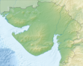
- N: 24°49'00" N (24.82°N)
- S: 19°57'00" N (19.9500°N)
- W: 68°00'00" O (68.0000°O)
- O: 74°37'12" O (74.62°O)
English: Location map of Gujarat
Equirectangular projection. Geographic limits of the map:
- N: 24°49'00" N (24.8167°N)
- S: 19°57'00" N (19.9500°N)
- W: 68°00'00" E (68.0000°E)
- E: 74°37'12" E (74.62°E)
(Reusing this file)
I, the copyright holder of this work, hereby publish it under the following licenses:

|
Permission is granted to copy, distribute and/or modify this document under the terms of the GNU Free Documentation License, Version 1.2 or any later version published by the Free Software Foundation; with no Invariant Sections, no Front-Cover Texts, and no Back-Cover Texts. A copy of the license is included in the section entitled GNU Free Documentation License. |
This file is licensed under the Creative Commons Attribution-Share Alike 3.0 Unported license.
- You are free:
- to share – to copy, distribute and transmit the work
- to remix – to adapt the work
- Under the following conditions:
- attribution – You must give appropriate credit, provide a link to the license, and indicate if changes were made. You may do so in any reasonable manner, but not in any way that suggests the licensor endorses you or your use.
- share alike – If you remix, transform, or build upon the material, you must distribute your contributions under the same or compatible license as the original.
You may select the license of your choice.
-
 since August 15, 2013
 -
 since August 15, 2013 (coloured and named)
 -
 until August 15, 2013
 -


.svg)


|
This map has been made or improved in the German Kartenwerkstatt (Map Lab). You can propose maps to improve as well.
|


