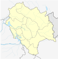
File:India Himachal Pradesh Location Map.svg
Click on a date/time to view the file as it appeared at that time.
| Date/Time | Thumbnail | Dimensions | User | Comment | |
|---|---|---|---|---|---|
| current | 03:54, 25 May 2021 |  | 953 × 931 (271 KB) | C1MM | c rivers and borders |
| 03:49, 27 January 2021 |  | 1,101 × 1,075 (271 KB) | C1MM | Fixed borders of districts | |
| 18:26, 14 April 2020 |  | 1,735 × 1,761 (129 KB) | C1MM | Fixed colors | |
| 18:19, 14 April 2020 |  | 1,735 × 1,761 (129 KB) | C1MM | Resized | |
| 18:15, 14 April 2020 |  | 1,735 × 1,761 (129 KB) | C1MM | Made position accurate | |
| 18:14, 14 April 2020 |  | 1,735 × 1,761 (127 KB) | C1MM | Uploaded a work by https://en.wikipedia.org/key/User:Planemad from https://commons.wikimedia.org/key/File:Himachal_Pradesh_locator_map.svg with UploadWizard |
File usage
More than 100 pages use this file. The following list shows the first 100 pages that use this file only. A full list is available.
- Abdul Hamid (soldier)
- Arki, India
- Baddi
- Bakloh
- Banikhet
- Banjar, India
- Barog
- Bhimakali Temple
- Bhota
- Bhuntar
- Bilaspur, Himachal Pradesh
- Chail, Himachal Pradesh
- Chamba, Himachal Pradesh
- Chaupal, Himachal Pradesh
- Chharabra
- Chintpurni
- Chitkul
- Churdhar Sanctuary
- Dagshai
- Dalhousie, India
- Dalhousie Cantonment
- Daranghati Sanctuary
- Daulatpur, Himachal Pradesh
- Deothsidh
- Dera Gopipur
- Dhankar Gompa
- Dhanpur, Himachal Pradesh
- Dharamshala
- Dhiraina
- Gagret
- Ghumarwin
- Great Himalayan National Park
- Hamirpur, Himachal Pradesh
- Haripur Guler
- Hidimba Devi Temple
- Jakhu Temple
- Jawalamukhi
- Jogindernagar
- Jubbal
- Junga, Himachal Pradesh
- Jutogh
- Kalpa, Himachal Pradesh
- Kangra, Himachal Pradesh
- Kangra Airport
- Kardang
- Kasauli
- Khajjiar
- Kotkhai
- Kufri, India
- Kullu
- Kullu–Manali Airport
- Kyelang
- Mahunag
- Malana, Himachal Pradesh
- Manali, Himachal Pradesh
- Mant Khas
- Mashobra
- McLeod Ganj
- Mehatpur Basdehra
- Nadaun, Himachal Pradesh
- Naggar, Himachal Pradesh
- Nagrota Bagwan
- Nahan
- Naina Devi
- Nalagarh
- Nauni
- Nerwa, Shimla
- Nurpur, Himachal Pradesh
- Palampur, Himachal Pradesh
- Paonta Sahib
- Parwanoo
- Pin Valley National Park
- Pubowal
- Rajgarh, Himachal Pradesh
- Rampur, Himachal Pradesh
- Reckong Peo
- Rehan, India
- Rewalsar, India
- Rohru
- Sabathu
- Sadhupul
- Santokhgarh
- Sar Pass Trek
- Sarkaghat
- Seoni, Himachal Pradesh
- Shimla
- Shimla Airport
- Solan
- Sundar Nagar
- Swarghat
- Tabo, Himachal Pradesh
- Taksal
- Talai
- Tashigang, Himachal Pradesh
- Thaneek Pura
- Theog
- Una, Himachal Pradesh
- Waknaghat
- Yol, Himachal Pradesh
- Zakatkhana
View more links to this file.
Global file usage
The following other wikis use this file:
- Usage on ar.wikipedia.org
- Usage on bn.wikipedia.org
- বিলাসপুর, হিমাচল প্রদেশ
- চুওয়ারি খাস
- দাগশাই
- ডালহৌসি সেনানিবাস
- দেরা গোপিপুর
- গাগ্রেত
- ঘুমারওয়িন
- জুব্বাল
- জুতোগ
- কাংরা
- কোতখাই
- মন্ত খাস
- নায়না দেবী
- বাদ্দি
- রোহরু
- সবাথু
- সান্তখগ্রহ
- সেওনি, হিমাচল প্রদেশ
- সোলান
- সুন্দরনগর
- থেওগ
- বানজার
- তিরা সুজনপুর
- ইয়ল
- ভোটা
- চাম্বা
- মানালি, হিমাচল প্রদেশ
- ধাঙ্কার গ্রাম
- কল্পা
- মডিউল:অবস্থান মানচিত্র/উপাত্ত/ভারত হিমাচল প্রদেশ
- মডিউল:অবস্থান মানচিত্র/উপাত্ত/ভারত হিমাচল প্রদেশ/নথি
- হিড়িম্বা দেবী মন্দির
- ত্রিলোকপুর মন্দির
- Usage on de.wikipedia.org
- Usage on de.wikivoyage.org
- Usage on eo.wikipedia.org
- Usage on es.wikipedia.org
View more global usage of this file.