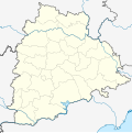
File:India Telangana Location Map.svg
Click on a date/time to view the file as it appeared at that time.
| Date/Time | Thumbnail | Dimensions | User | Comment | |
|---|---|---|---|---|---|
| current | 06:49, 23 January 2024 |  | 851 × 852 (367 KB) | Milenioscuro | Reverted to version as of 03:20, 4 August 2021 (UTC) |
| 08:55, 10 January 2024 |  | 1,778 × 1,466 (199 KB) | Thotakuri Paramesh | Reverted to version as of 04:12, 30 May 2016 (UTC) | |
| 03:20, 4 August 2021 |  | 851 × 852 (367 KB) | C1MM | Corrected district | |
| 04:27, 7 June 2021 |  | 851 × 852 (367 KB) | C1MM | c rivers and borders | |
| 18:28, 15 January 2021 |  | 443 × 443 (228 KB) | C1MM | Added Jangaon district | |
| 18:58, 1 August 2020 |  | 443 × 443 (227 KB) | C1MM | Uploaded new districts | |
| 17:09, 16 April 2020 |  | 1,778 × 1,466 (199 KB) | C1MM | Reverted to version as of 04:20, 30 May 2016 (UTC) | |
| 17:00, 16 April 2020 |  | 443 × 443 (229 KB) | C1MM | Changed colors and cropped to be more accurate | |
| 04:20, 30 May 2016 |  | 1,778 × 1,466 (199 KB) | Milenioscuro | borders | |
| 04:16, 30 May 2016 |  | 1,778 × 1,466 (199 KB) | Milenioscuro | borders |
File usage
More than 100 pages use this file. The following list shows the first 100 pages that use this file only. A full list is available.
- Adilabad
- Alampuram (Hemalapuram)
- Badepalle
- Banapuram
- Basara, Telangana
- Begumpet Airport
- Bellampalle
- Bhadrachalam
- Bhainsa
- Bheemavaram, Khammam district
- Bhongir
- Bodhan
- Chatakonda
- Choutuppal
- Chunchupalle
- Dasnapur
- Devarakonda
- Dharmapuri, Telangana
- Dharmasagar
- Eddumailaram
- Elgandal Fort
- Farooqnagar
- Gadwal
- Godavarikhani
- Gummadidala
- Hanamkonda
- Hyderabad
- Isnapur
- Jagirpally
- Jagtial
- Jallaram
- Jangaon
- Jannaram mandal
- Kagaznagar, Telangana
- Kakatiya Institute of Technology and Science
- Kaleshwaram
- Kallur, Khammam district
- Kamareddy
- Kapra
- Karimnagar
- Kasu Brahmananda Reddy National Park
- Kattangur
- Kazipet
- Khammam
- Khammam Fort
- Kodad
- Korutla
- Kothagudem
- Kukatpally
- Kyathanpally
- L. B. Nagar
- Luxettipet
- Madaram
- Madgul
- Madhapur
- Madhira
- Mahadevpur
- Mahavir Harina Vanasthali National Park
- Mahbubnagar
- Malkajgiri
- Mancherial
- Mandamarri
- Manthani
- Manuguru
- Medak
- Meerpet–Jillelguda
- Mellachervu
- Miryalaguda
- Mothkur
- Mrugavani National Park
- Mudigonda
- Nagarkurnool
- Nakrekal
- Nalgonda
- Narayanpet
- Narsingi, Ranga Reddy district
- Nizam College
- Nizamabad, Telangana
- Osmania University
- Parnasala
- Pendekanti Law College
- Pinapaka Pattinagar
- Pulimamidi
- Quthbullapur
- Raikal
- Ramadugu
- Ramagundam
- Ramappa Engineering College
- Sangareddy
- Sanghi Nagar
- Secunderabad
- Siddipet
- Sitaphalmandi
- Suryapet
- University of Hyderabad
- Vadapally
- Vallampally
- Varshakonda
- Vemulawada, Rajanna Sircilla district
- Warangal
View more links to this file.
Global file usage
The following other wikis use this file:
- Usage on bh.wikipedia.org
- Usage on bn.wikipedia.org
- হায়দ্রাবাদ
- জহিরাবাদ
- আলমপুর, যোগুলাম্বা গাদোয়াল জেলা
- আদিলাবাদ
- করিমনগর
- টেমপ্লেট:অবস্থান মানচিত্র ভারত তেলেঙ্গানা
- চিক্কাডপল্লি
- হিমায়াত নগর, হায়দ্রাবাদ
- আব্দুল্লাপুর (গ্রাম)
- অ্যাবিডস
- রাজীব গান্ধী আন্তর্জাতিক বিমানবন্দর
- বাঞ্জারা হিলস
- মাহবুবনগর
- জুবিলি হিলস
- বেগমপেট
- গোলকোন্ডা দুর্গ
- ওয়ারাঙ্গল
- সেকেন্দ্রাবাদ জংশন রেলওয়ে স্টেশন
- হায়দ্রাবাদের বুদ্ধ মূর্তি
- গণেশের মূর্তি
- জানওয়াড়া
- Usage on ceb.wikipedia.org
- Usage on de.wikipedia.org
- Usage on eo.wikipedia.org
- Usage on es.wikipedia.org
View more global usage of this file.