Click on a date/time to view the file as it appeared at that time.
| Date/Time | Thumbnail | Dimensions | User | Comment |
|---|
| current | 03:57, 25 April 2007 | 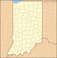 | 288 × 293 (10 KB) | Ruhrfisch | == Summary == {{Information| |Description= Locator Map of Indiana, United States |Source= taken from US Census website [http://factfinder.census.gov/] and modified by User:Ruhrfisch |Date= April 2007 |Author= US Census, Ruhrfisch |Permission= US Cens |
| 01:08, 2 April 2007 | 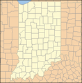 | 288 × 293 (10 KB) | Ruhrfisch | {{Information| |Description= Locator Map of Indiana, United States |Source= taken from US Census website [http://factfinder.census.gov/] and modified by User:Ruhrfisch |Date= April 2007 |Author= US Census, Ruhrfisch |Permission= US Census / US Govern |
The following pages on the English Wikipedia use this file (pages on other projects are not listed):
The following other wikis use this file:
- Usage on ceb.wikipedia.org
- Usage on de.wikipedia.org
- Usage on fa.wikipedia.org
- Usage on hu.wiktionary.org
- Usage on zh.wikipedia.org


