File:Ingham County Tornado Graphic.png
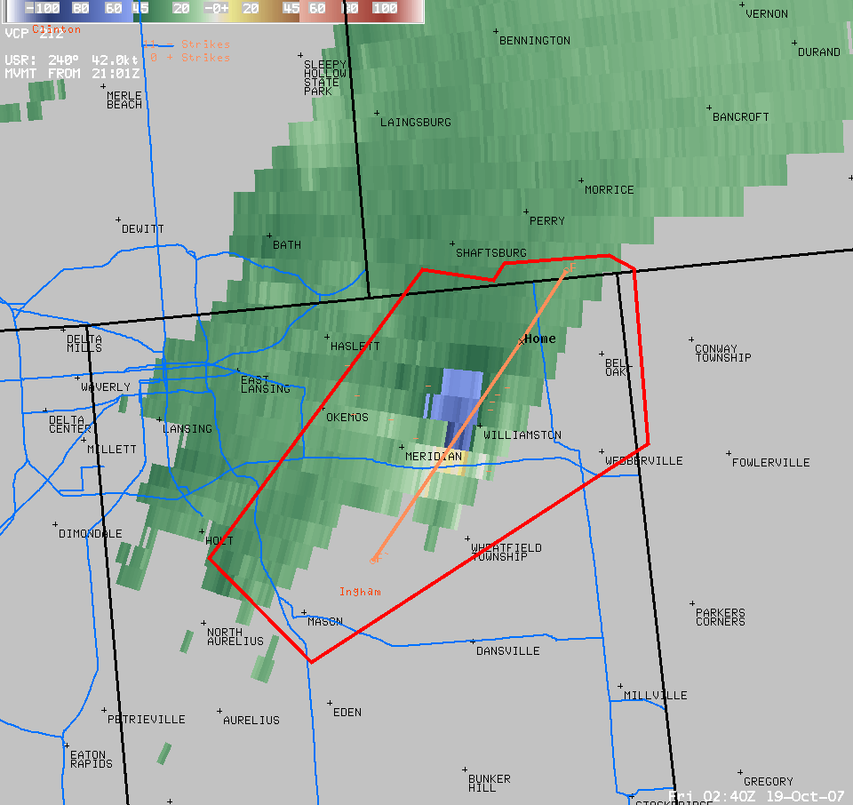
This is a graphic showing the storm that spawned the w:Ingham County, Michigan tornado during the w:Mid-October 2007 tornado outbreak. This tornado killed 2 people. The orange line represents the track of the tornado and the red perimeter represents the area covered by the storm based warning
This was the first time in Michigan that storm-based warnings were used for an outbreak, meaning in which the National Weather Service wants to warn smaller areas for shorter periods for the threat of a tornado. (Courtesy of NWS Grand Rapids, Michigan) Source:http://www.crh.noaa.gov/crnews/display_story.php?wfo=grr&storyid=10681&source=0
Licensing
This image is in the public domain because it contains materials that originally came from the U.S. National Oceanic and Atmospheric Administration, taken or made as part of an employee's official duties.
|