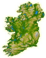
File:Ireland Geographical Map.png
NASA: IotD ID 16853 – http://visibleearth.nasa.gov/view_rec.php?id=17124
blue sea removed and set to transparent
Author
NASA, see Image:Topography Ireland.jpg for more information
Permission
(Reusing this file)
public domain
Other versions
original, bigger version at Image:Topography Ireland.jpg
blue sea removed and set to transparent
(Reusing this file)
| This file is in the public domain in the United States because it was solely created by NASA. NASA copyright policy states that "NASA material is not protected by copyright unless noted". (See Template:PD-USGov, NASA copyright policy page or JPL Image Use Policy.) | ||
 |
Warnings:
|