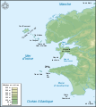
File:Iroise Sea Map-fr.svg
Click on a date/time to view the file as it appeared at that time.
| Date/Time | Thumbnail | Dimensions | User | Comment | |
|---|---|---|---|---|---|
| current | 22:29, 4 December 2007 |  | 776 × 867 (406 KB) | Korrigan | typo |
| 17:12, 4 December 2007 |  | 776 × 867 (406 KB) | Pinpin | labels in italic | |
| 17:10, 4 December 2007 |  | 776 × 867 (406 KB) | Pinpin | add labels | |
| 20:00, 3 December 2007 |  | 776 × 867 (411 KB) | Pinpin | ||
| 19:58, 3 December 2007 |  | 776 × 867 (411 KB) | Pinpin | {{Information |Description={{fr|Carte topographique du Finistère et de la mer d'Iroise en France : version française}} {{en|Topographic map of Finistère in France and iroise sea : french version}} |Source=Own work <br/>Topographic map : [http://www2.jp |
File usage
The following pages on the English Wikipedia use this file (pages on other projects are not listed):
Global file usage
The following other wikis use this file:
- Usage on az.wikipedia.org
- Usage on ca.wikipedia.org
- Usage on cy.wikipedia.org
- Usage on da.wikipedia.org
- Usage on de.wikipedia.org
- Usage on el.wikipedia.org
- Usage on eo.wikipedia.org
- Usage on es.wikipedia.org
- Usage on frr.wikipedia.org
- Usage on fr.wikipedia.org
- Pointe de Corsen
- Pointe du Raz
- Côte des Abers
- Baie des Trépassés
- Presqu'île de Crozon
- Baie d'Audierne
- Wikipédia:Atelier graphique/Cartes/Archives/août 2008
- Wikipédia:Atelier graphique/Cartes/Archives/septembre 2008
- Projet:Impression/Wikigraphistes
- Parc naturel marin d'Iroise
- Wikipédia:Atelier graphique/Cartes/Archives/Demandes mises en sommeil/Monde
- Usage on fr.wiktionary.org
- Usage on is.wikipedia.org
- Usage on it.wikipedia.org
- Usage on ja.wikipedia.org
- Usage on lv.wikipedia.org
- Usage on pt.wikipedia.org
View more global usage of this file.